Measuring the movement with satellites: InSAR (Interferometric Synthetic Aperture Radar)
InSAR is a radar technique used in geodesy that measures the changes between two or more radar images taken of the same location at different times (days to years) and generates maps of how a surface has deformed over time. Satellite InSAR is particularly useful to measure changes over thousands of square kilometers.
Be a Scientist! How much has the volcano grown?
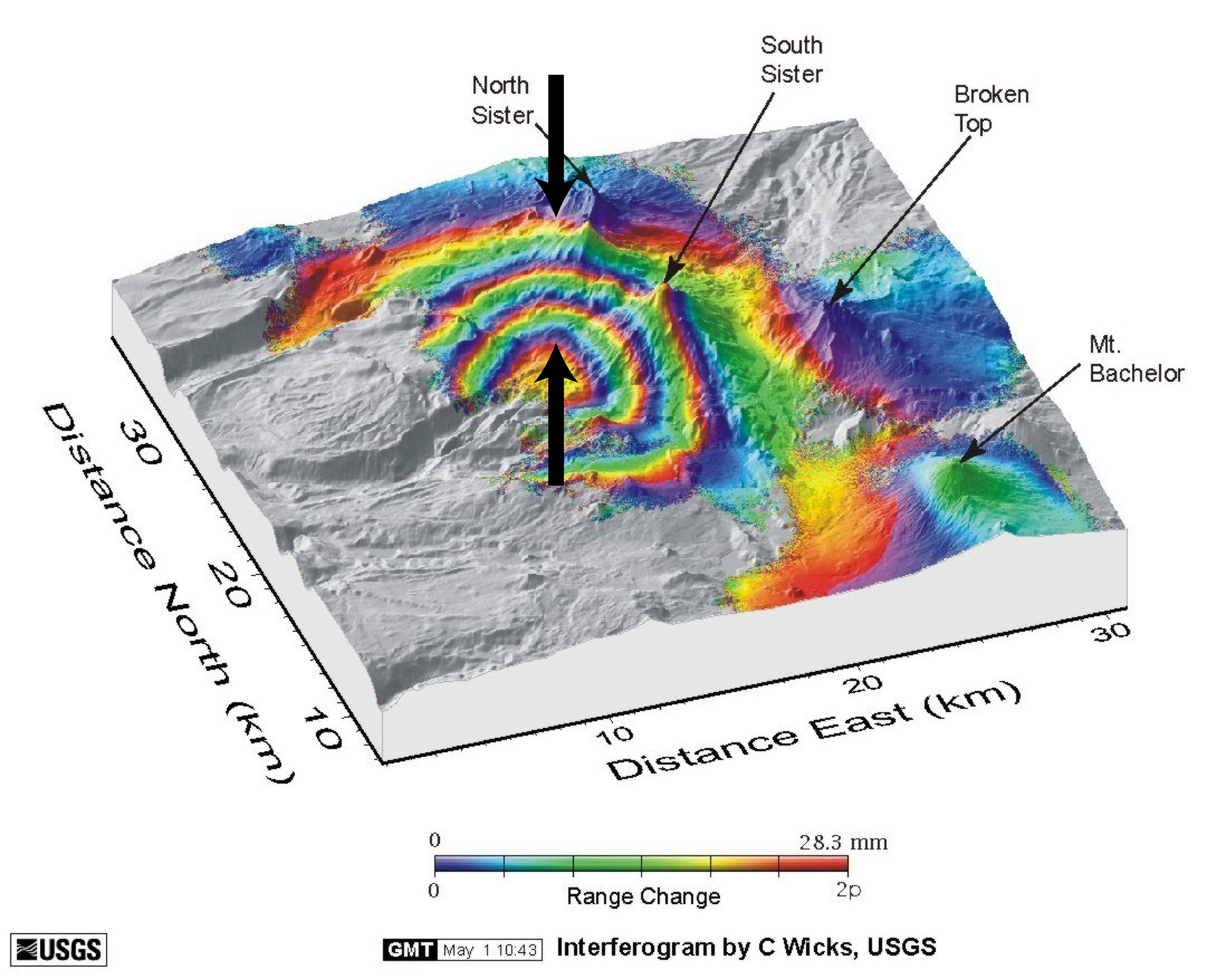
The colorful rings in the InSAR image above show that this volcano in eastern Oregon has bulged upwards. Each set of colored rings (from purple to red) equals 3 cm (1.18 inches) of uplift caused by magma rising inside the volcano. How much uplift do you see between the two arrows? Hint: count the number of times you go from purple to red, starting at the bottom arrow.
 Get the Answer
LiDAR is an optical sensing technology that measures the distance to a target by bouncing light off the object, often using pulses from a laser.

