Answer
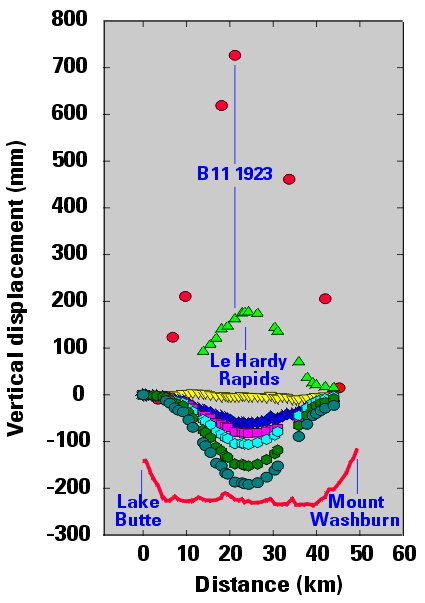
Researchers have been measuring the ground elevation at Yellowstone National Park since 1923! This graph shows how the ground sank down over time. The ground started at the level of the red dots in 1923, and by 1995 had dropped down about 900 millimeters (35 inches) to the level of the teal dots.
From 2004 to 2011, the ground had been bulging upwards, in some places by more than 180 mm (7 inches). The most recent GPS data shows that the ground is sinking back down. This bulging and sinking of a volcano is normal and is sometimes referred to as "a breathing volcano".