The Alaska Earthquake Center uses an automatic location program that looks at all earthquake data in real-time and looks for signals that occur at multiple stations at the same time.
It then tries to locate the event.
Analysts monitor all automatic event locations.
Analysts monitor all automatic event locations.
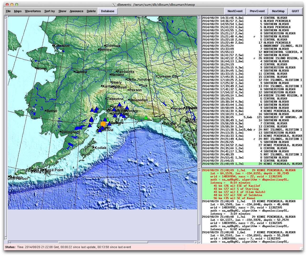
Analysts then check each event and seismic arrival, then relocate each event to refine the location, depth and magnitude.
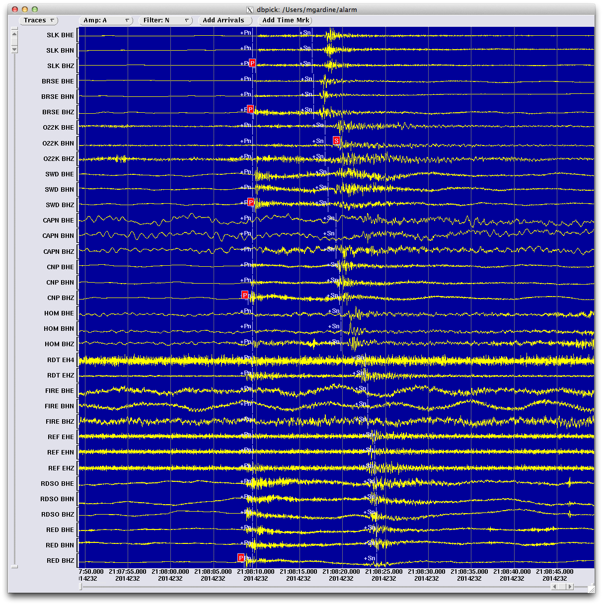
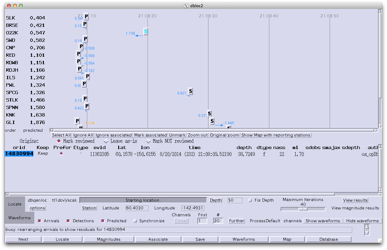
The photos below show the waveforms used to locate an earthquake (left) and the information the analysts used to determine if a location is good (right). The P corresponds with the arrival of the compressional (or primary) wave. The S corresponds to the shear (or secondary) wave. The computer uses the time differences between these arrivals to locate the earthquake.
The photos below show the waveforms used to locate an earthquake (left) and the information the analysts used to determine if a location is good (right). The P corresponds with the arrival of the compressional (or primary) wave. The S corresponds to the shear (or secondary) wave. The computer uses the time differences between these arrivals to locate the earthquake.