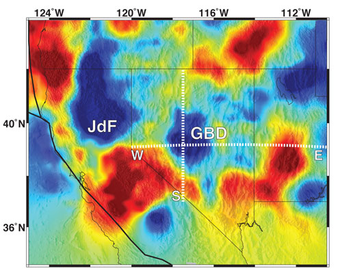
Tomography:
Earthscope instruments are providing high resolution views of the interior
of the Earth under the Basin and Range Province. The western and eastern
edges of the Basin and Range Province are composed of warmer material. However,
the greater resolution is showing that the center of the Basin and Range
Province may not be warmer. Seismometers from USArray and other EarthScope
projects allow us to see where the hot and cold regions are with greater
detail then we could have only a few years ago. JdF is the descending Juan
de Fuca slab and GBD is the Great Basin Drip.