Hazard Map
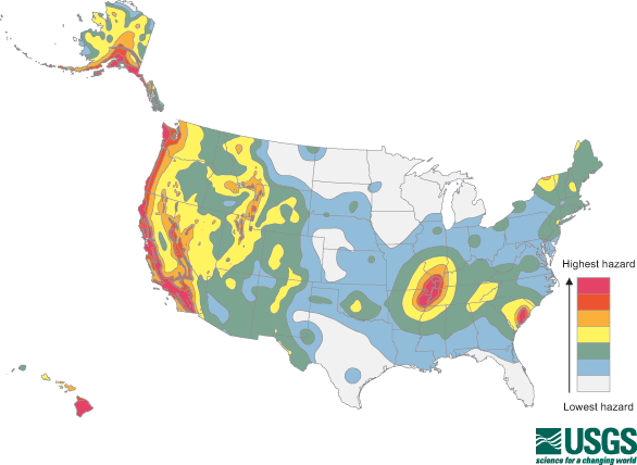
The national seismic hazard map represents the shaking hazard from earthquakes as colored bands of equal hazard. The shaking hazard is based on current information about the rate at which earthquakes occur in different areas and how far strong shaking extends from earthquake sources. The New Madrid seismic zone (large red area in the middle of the country) has a shaking hazard equal to some parts of California along the San Andreas Fault.
EarthScope instruments are providing more accurate data about the rate of occurrence of earthquakes and the location of faults across the United States. This data could lead to a more accurate seismic hazard map. The hazard map is used to calculate earthquake insurance rates and affects the cost of new building construction.