How Do We Know the Ground is Moving?
EarthScope Measures the Ground on the Move
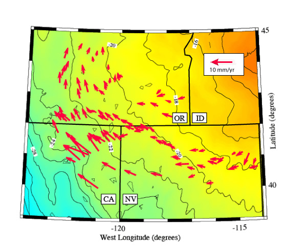
EarthScope instruments are measuring the motion of the
Basin and Range Province. The mountains are rising about 0.3 mm per year, the
tectonic plate is extending 5 mm per year.
Each arrow represents a speed (the length of the arrow) and a direction (which way the arrow is pointing) that a single scientific GPS station anchored to the ground has moved relative to regions east of the Rocky Mountains. The base of the arrow is the location of the GPS station, and the head of the arrow is the direction it is moving.
Question 1:
Do you see a pattern in the way the Basin and Range Province
scientific GPS stations are moving? How would you describe
it?
Question 2:
Why are there a lot of arrows in one place, and no arrows in others?
Question 3:
Why are some scientific GPS stations moving in a strange direction?
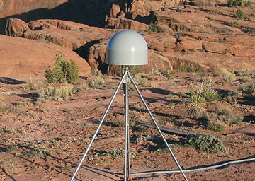
A scientific GPS instrument is anchored to the ground.
