Answer:
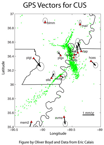
Geodesy is a branch of earth science that deals with the measurement and representation of the Earth in three dimensions. Global positioning system (GPS) instruments can be used to collect extremely precise measurements of the motion of the surface of the Earth. Motions smaller than the diameter of a human hair can be measured.GPS instruments have monitored the motion of the New Madrid seismic zone for over ten years. No net motion on the faults has been seen. This seems to indicate that stress is not building up in the faults. Notice that the black arrows in the image are pointing in all different directions and have different lengths. The random motions cancel each other out.
What do these results mean? One explanation is that stress is not building up in the faults of the New Madrid seismic zone. No stress, no new big earthquakes. A second explanation is that the thick layers of sediments in this region mask the true motions of the faults so that stress buildup is not seen by GPS instruments. Recurring stress buildup is seen in the geologic data.