Summary
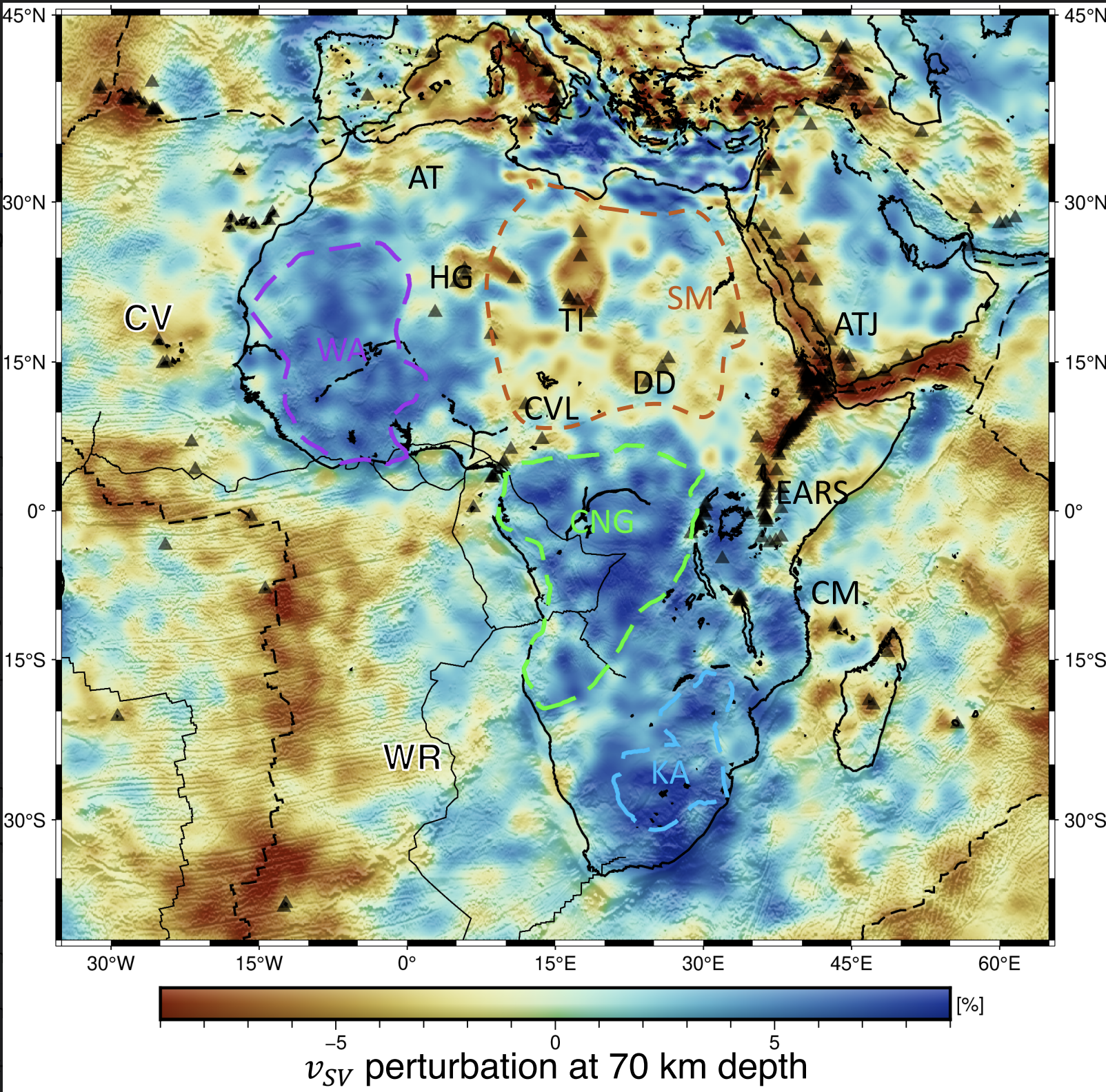
A seismic model of the African Plate, made with the technique of full waveform inversion.
Quicklinks
Description
| Name | AFR2022 |
| Title | Full-waveform tomography of the African Plate using dynamic mini-batches |
| Type | 3-D Tomography Earth Modell |
| Sub Type | Velocity (km/s) |
| Year | 2023 |
| Data Revision | r0.0 (revision history) |
| Short Description | A seismic velocity model of the African Plate, constructed with earthquake data and the technique of full waveform tomography. |
| Authors: | Dirk Philip van Herwaarden, Department of Earth Sciences, Institute of Geophysics, ETH Zurich, 8092 Zurich, Switzerland Solvi Thrastarson, Department of Earth Sciences, Institute of Geophysics, ETH Zurich, 8092 Zurich, Switzerland Vaclav Hapla, Department of Earth Sciences, Institute of Geophysics, ETH Zurich, 8092 Zurich, Switzerland Michael Afanasiev, Department of Earth Sciences, Institute of Geophysics, ETH Zurich, 8092 Zurich, Switzerland, Now at Mondaic AG Jeannot Trampert, Department of Earth Sciences, Utrecht University, Princetonlaan 8a, 3584 CB Utrecht, The Netherlands Andreas Fichtner, Department of Earth Sciences, Institute of Geophysics, ETH Zurich, 8092 Zurich, Switzerland |
| Reference Model | N/A |
| Prior Model | N/A |
| Model Download | AFR2022.r0.0.nc (see metadata) is the model with topography in netCDF 3 Classic format. |
| Model Home Page | https://cos.ethz.ch/models.html |
| Depth Coverage | 0 700 km |
| Area | latitude: -46° to 52°, longitude: -41° to 67° |
| Data Set Description | The model AFR2022 is based on recordings of 397 earthquakes recorded between 1997 and 2020. The dataset consists of 184,356 unique source-receiver pairs. |

Citations and DOIs
To cite the original work behind this Earth model:
- Herwaarden, D.-P. v., Thrastarson, S., Hapla, V., Afanasiev, M., Trampert, J., & Fichtner, A. (2023). Full-waveform tomography of the African Plate using dynamic mini-batches. Journal of Geophysical Research: Solid Earth, 128, e2022JB026023. https://doi.org/10.1029/2022JB026023
To cite IRIS DMC Data Products effort:
- Trabant, C., A. R. Hutko, M. Bahavar, R. Karstens, T. Ahern, and R. Aster (2012), Data Products at the IRIS DMC: Stepping Stones for Research and Other Applications, Seismological Research Letters, 83(5), 846–854, https://doi.org/10.1785/0220120032.
DOI for this EMC webpage: https://doi.org/10.17611/dp/emc.2023.africa.fwi.1
References
- G.C. Begg, W.L. Griffin, L.M. Natapov, Suzanne Y. O’Reilly, S.P. Grand, C.J. O’Neill, J.M.A. Hronsky, Y. Poudjom Djomani, C.J. Swain, T. Deen, P. Bowden; The lithospheric architecture of Africa: Seismic tomography, mantle petrology, and tectonic evolution. Geosphere 2009;; 5 (1): 23–50. https://doi.org/10.1130/GES00179.1
Credits
- r0.0 model provided by Dirk Philip van Herwaarden.
Revision History
revision r0.0: uploaded June 5, 2023.
Timeline
- 2023-06-06
- online


