Summary
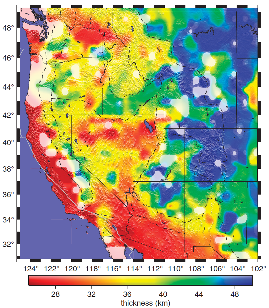
The model crustal thicknesses values are based on common conversion point (CCP) stacking of receiver functions calculated from data recorded by USArray stations and other permanent and temporary deployments in the western United States.
Quicklinks
Description
| Name | Crustal_Thickness_Error |
| Title | Crustal thickness values within the western United States derived from receiver function observations |
| Type | Crustal |
| Sub Type | thicknesses |
| Year | 2012 |
| Short Description | The model crustal thicknesses values are based on common conversion point (CCP) stacking of receiver functions calculated from data recorded by USArray stations and other permanent and temporary deployments in the western United States. |
| Authors: | |
| Hersh Gilbert | |
| Department of Earth, Atmospheric, and Planetary Sciences | |
| Purdue University | |
| West Lafayette, Indiana, 47907, USA | |
| Previous Model | N/A |
| Reference Model | N/A |
| Model Download | Crustal_Thickness_Error.nc (see metadata ), is the netCDF file for the model |
| Original Model Repository | http://dx.doi.org/10.1130/GES00720.S1 |
| Depth Coverage | |
| Area | Western United States (latitude: 30.7°/50.2°; longitude: -125°/-101°) |
| Data Set Description | [Gilbert, 2012], Crustal thicknesses are based on a dataset comprised of close to 50,000 P-to-S receiver functions recorded by stations in the western United States. Stacking the receiver functions into common conversion point (CCP) stacking bins facilities identifying lateral variations in crustal thickness. Thickness values range from less than 30 km thick to more than 50 km thick across the region. Errors associated with crustal thickness values vary between 0 and 4.5 km and are estimated from bootstrap resampling. |
| Supplemental Information | |

Citations and DOIs
To cite the original work behind this Earth model:
- Gilbert, H., 2012, Crustal structure and signatures of recent tectonism as influenced by ancient terranes in the western United States, Geosphere, 8, 141–157. https://doi.org/10.1130/GES00720.1
To cite IRIS DMC Data Products effort:
- Trabant, C., A. R. Hutko, M. Bahavar, R. Karstens, T. Ahern, and R. Aster (2012), Data Products at the IRIS DMC: Stepping Stones for Research and Other Applications, Seismological Research Letters, 83(5), 846–854, https://doi.org/10.1785/0220120032.
DOI for this EMC webpage:
References
- Gilbert, H., 2012, Crustal structure and signatures of recent tectonism as influenced by ancient terranes in the western United States, Geosphere, 8, 141–157. https://doi.org/10.1130/GES00720.1
Credits
Model provided by Hersh Gilbert
Timeline
- 2015-11-23
- online


