Summary
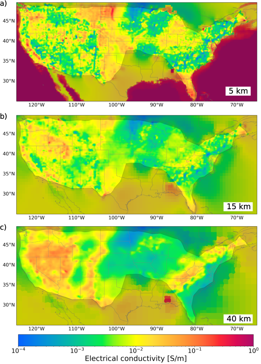
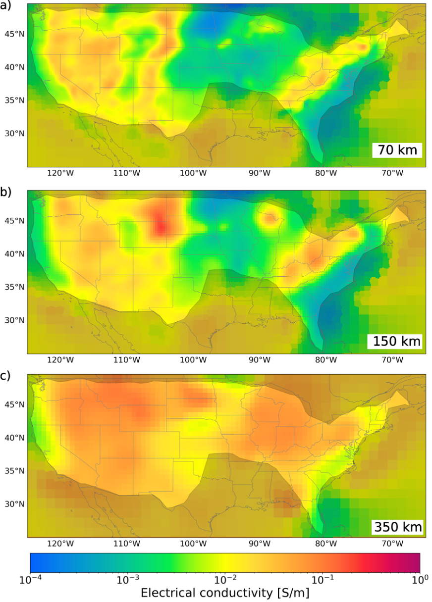
The Multi-scale Electrical Conductivity Model of the United States is derived by inverting the full MT impedance tensor from 1291 USArray stations.
Quicklinks
Description
| Name | MECMUS-2022 |
| Title | Multi-scale Electrical Conductivity Model of the United States |
| Type | 3-D Continental Electrical Conductivity Model |
| Sub Type | Long-period Magnetotelluric |
| Units | Siemens/meter |
| Year | 2022 |
| Data Revision | r0.0 (revision history) |
| Short Description | The Multi-scale Electrical Conductivity Model of the United States (MECMUS-2022) was derived by inverting the full MT impedance tensor from 1291 USArray stations. The inversion procedure is described in Munch, F. and Grayver, A. V., |
| Authors: | F. Munch,Institute of Geophysics, ETH Zurich, Sonneggstrasse 5, Zurich, 8092, Switzerland Berkeley Seismological Laboratory, University of California, Berkeley, United States A. Grayver, Institute of Geophysics and Meteorology, University of Cologne, Albertus-Magnus-Platz, 50923, Cologne, Germany |
| Reference Model | N/A |
| Prior Model | N/A |
| Inversion Software | GoFEM, (Grayver, 2015; Grayver and Kolev, 2015; Grayver et al., 2019) |
| Model Download | MECMUS-2022.r0.0.nc (see metadata) is the ORLA2022 model in netCDF 3 Classic format. |
| Model Home Page | N/A |
| Depth Coverage | 0 – 400km |
| Area | Focused on the contiguous United States (latitude: 25° to 50°, longitude: -125.0° to -65.0°) |
| Usage Notes | The model coordinates represent cell center coordinates, and the model parameters are evaluated at the cell centers |
| Data Set Description | Frequency domain long-period (10 to 3e4 secs) magnetotelluric (MT) data from USArray MT, USGS MT, USMTArray available from IRIS EMTF database |


Citations and DOIs
To cite the original work behind this Earth model:
- Munch, F. and Grayver, A. V., (2023). Multi-scale imaging of 3-D electrical conductivity structure under the contiguous US constrains lateral variations in the upper mantle water content, Earth and Planetary Science Letters. https://doi.org/10.1016/j.epsl.2022.117939
To cite IRIS DMC Data Products effort:
- Trabant, C., A. R. Hutko, M. Bahavar, R. Karstens, T. Ahern, and R. Aster (2012), Data Products at the IRIS DMC: Stepping Stones for Research and Other Applications, Seismological Research Letters, 83(5), 846–854, https://doi.org/10.1785/0220120032.
DOI for this EMC webpage:
https://doi.org/10.17611/dp/emc.2022.mecmus.1
References
- Grayver, A.V., 2015. Parallel three-dimensional magnetotelluric inversion using adaptive finite-element method. Part I: theory and synthetic study. Geophysical Journal International 202, 584–603.
- Grayver, A.V., van Driel, M., Kuvshinov, A.V., 2019. Three-dimensional magnetotelluric modelling in spherical Earth. Geophysical Journal International 217, 532–557.
- Grayver, A.V., Kolev, T.V., 2015. Large-scale 3D geoelectromagnetic modeling using parallel adaptive high-order finite element method. Geophysics 80, E277–E291
Credits
- r0.0 model provided by Federico Munch.
Revision History
revision r0.0: uploaded December 8, 2022.
Timeline
- 2022-12-12
- online


