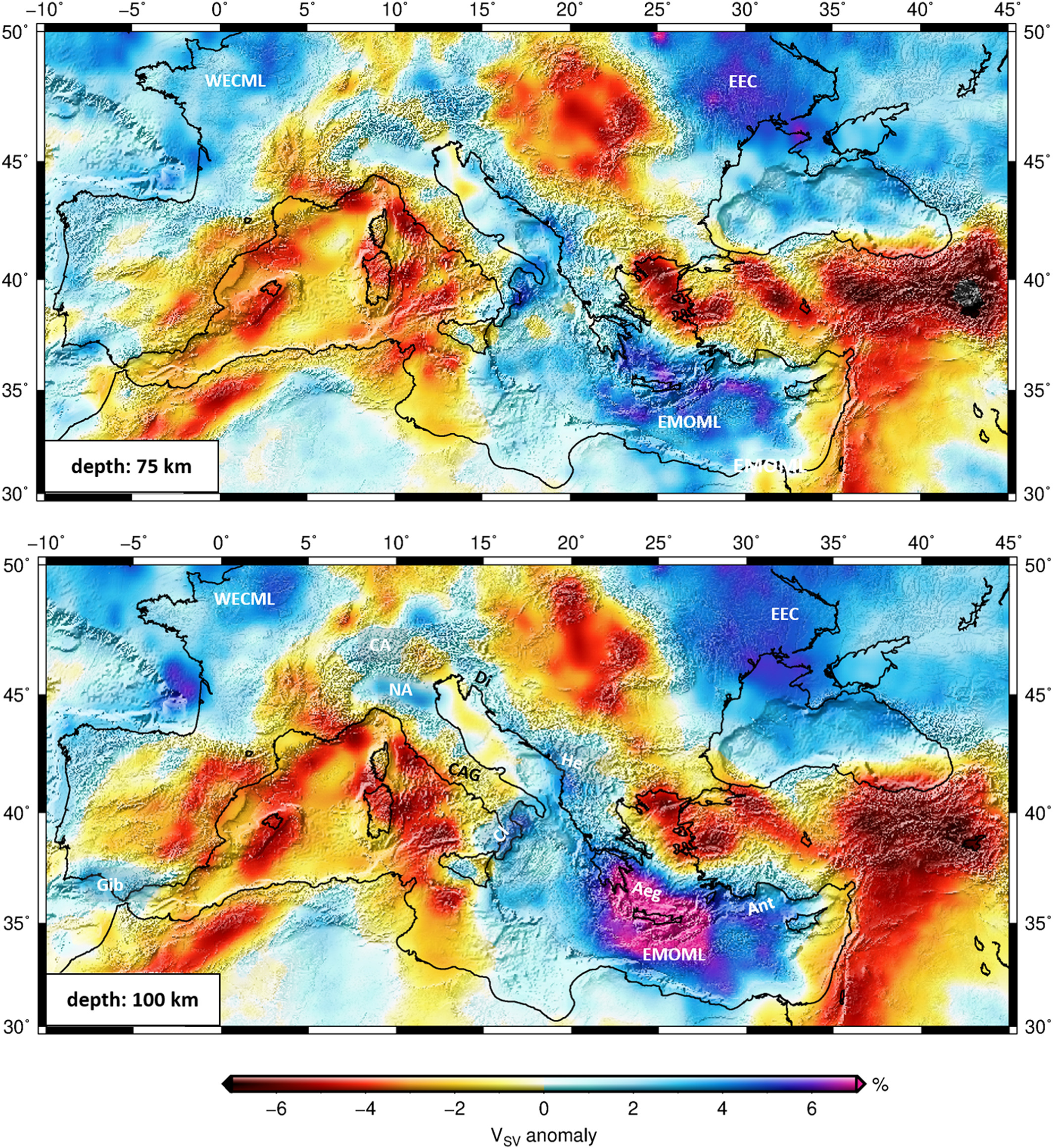
Summary
MeRE2020 is a high-resolution Shear‐wave velocity model of the Mediterranean upper mantle down to about 300 km, constrained by a very large set of over 200,000 broadband (8‐350 s), inter‐station, Rayleigh‐wave, phase‐velocity curves.
Quicklinks
Description
| Name | MeRE2020 |
| Title | The Slab Puzzle of the Alpine‐Mediterranean Region: Insights from a new, High‐Resolution, Shear‐Wave Velocity Model of the Upper Mantle. |
| Type | 3-D Surface Wave Tomography Earth Model |
| Sub Type | S-wave velocity(km/s) |
| Year | 2020 |
| Data Revision | r.0.0 (revision history) |
| Short Description | High-resolution Shear‐wave velocity model of the Mediterranean upper mantle down to about 300 km, constrained by a very large set of over 200,000 broadband (8‐350 s), inter‐station, Rayleigh‐wave, phase‐velocity curves. Phase‐velocity maps computed using these measurements were inverted for depth‐dependent, shear‐wave velocities using a new implementation of the stochastic particle‐swarm‐optimization algorithm (PSO). The resulting three‐dimensional (3‐D) model makes possible an inventory of slab segments across the Mediterranean. Fourteen slab segments of 200‐800 km length along‐strike are identified. We distinguish three categories of subducted slabs: attached slabs reaching down to the bottom of the model; shallow slabs of shorter length in down‐dip direction, terminating shallower than 300 km depth; and detached slab segments. The new high‐resolution tomography demonstrates the intricate relationships between slab fragmentation and the evolution of the relatively small and highly curved subduction zones and collisional orogens characteristic of the Mediterranean realm. |
| Authors: | Amr El-Sharkawy: Institute of Geosciences, Christian‐Albrechts‐Universität zu Kiel, Kiel, Germany National Research Institute of Astronomy and Geophysics (NRIAG), Helwan, Cairo, Egypt Thomas Meier, Christian Weidle, and Daniel Köhn: Institute of Geosciences, Christian‐Albrechts‐Universität zu Kiel, Kiel, Germany Sergei Lebedev: School of Cosmic Physics, Geophysics Section, Dublin Institute for Advanced Studies, Dublin, Ireland Jan Behrmann: GEOMAR Helmholtz Centre for Ocean Research, Kiel, Germany Mona Hamada: National Research Institute of Astronomy and Geophysics (NRIAG), Helwan, Cairo, Egypt Luigia Cristiano: Deutsches GeoForschungsZentrum (GFZ), Potsdam, Germany |
| Previous Model | None |
| Reference Model | None |
| Model Download | El-Sharkawy-etal-G3.2020-MeRE2020-Mediterranean-0.0.nc (see metadata ), is the netCDF file for the model |
| Model Homepage | https://www.seismologie.ifg.uni-kiel.de/ |
| Depth Coverage | Upper mantle depths (~ 60 to ~ 300 km) |
| Area | The Alpine-Mediterranean domain (latitudes: 30°N/50°N, longitudes: -10°E/45°E) |
| Data Set Description | 200.000 fundamental-mode, Rayleigh-wave, inter-station, earthquake-based phase-velocity dispersion curves. More than 3900 earthquakes recorded by around 4500 publically available seismic station provided by IRIS and WebDC in the time range 1990-2015 are used in this study. This is combined with restricted data from about 25 stations of the Egyption National Seismological Network. Supplemental Information |

Citations and DOIs
To cite the original work behind this Earth model:
- El‐Sharkawy, A., Meier, T., Lebedev, S., Behrmann, J. H., Hamada, M., Cristiano, L., et al. (2020). The slab puzzle of the Alpine‐Mediterranean region: Insights from a new, high‐resolution, shear wave velocity model of the upper mantle. Geochemistry, Geophysics, Geosystems, 21, e2020GC008993. https://doi.org/10.1029/2020GC008993
To cite IRIS DMC Data Products effort:
- Trabant, C., A. R. Hutko, M. Bahavar, R. Karstens, T. Ahern, and R. Aster (2012), Data Products at the IRIS DMC: Stepping Stones for Research and Other Applications, Seismological Research Letters, 83(5), 846–854, https://doi.org/10.1785/0220120032.
DOI for this EMC webpage: https://doi.org/10.17611/dp/emc.2020.meresvelsh.1
Credits
- V.1.0 model provided by Amr El-Sharkawy.
Revision History
revision r.0.0: uploaded September 29, 2020.
Timeline
- 2020-09-29
- online


