Summary
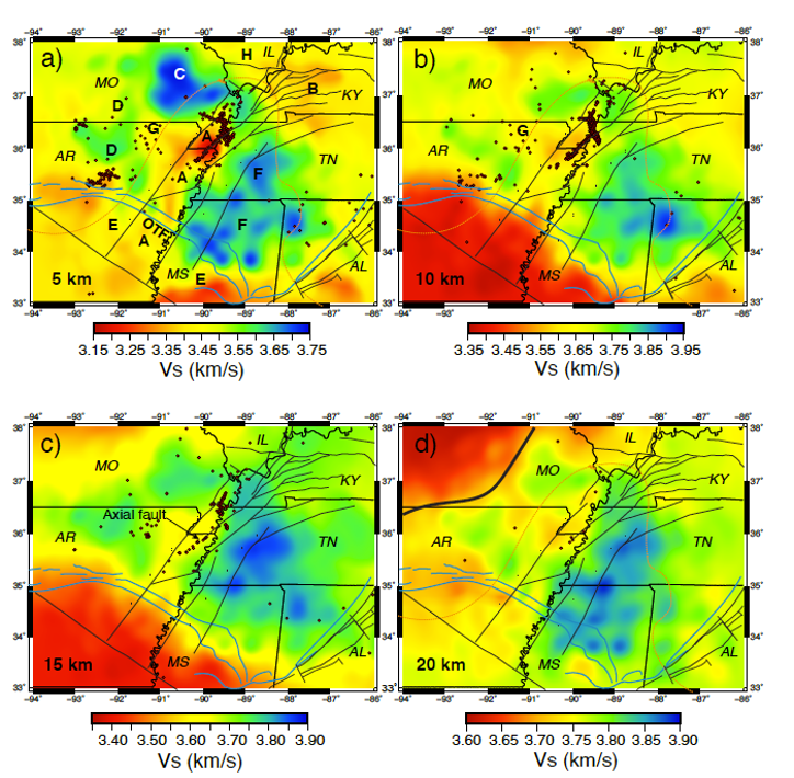
The NME_3D_Vs shear wave velocity Earth model is based on a full waveform ambient noise tomographic method using the extracted empirical Green’s function from about 277 stations around the Northern Mississippi embayment.
Quicklinks
Description
| Name | NME_3D_Vs |
| Title | Full Waveform Ambient Noise Tomography for the Northern Mississippi Embayment |
| Type | 3-D Tomography Earth Model |
| Sub Type | Shear wave velocity (km/s) |
| Year | 2021 |
| Data Revision | r0.0 (revision history) |
| Short Description | This three-dimensional shear wave velocity model is based on a full waveform ambient noise tomographic method using the extracted empirical Green’s function from about 277 stations around the Northern Mississippi embayment. |
| Authors: | Y. Yang, Center for Earthquake Research and Information, University of Memphis, Memphis, TN, USA Charles Langston, Center for Earthquake Research and Information, University of Memphis, Memphis, TN, USA Christine Powell, Center for Earthquake Research and Information, University of Memphis, Memphis, TN, USA William Thomas, Geological Survey of Alabama, University of Alabama, Tuscaloosa, AL, USA |
| Reference Model | |
| Previous Model | |
| Model Download | NME-3D-Vs.r0.0.nc (see metadata) is the above model in netCDF 3 Classic format. |
| Model Homepage | N/A |
| Depth Coverage | 0 to ~47.5km |
| Area | The Northern Mississippi embayment (latitude: 33° to ~38°, longitude: -93° to ~-88°) |
| Data Set Description | This three-dimensional shear wave velocity model is based on a full waveform ambient noise tomographic method using the extracted empirical Green’s function between 8 to 40s. The data are collected from all the available broadband recordings of ambient noise around and within the Northern Mississippi embayment (33°N – 38°N, 94°W – 86°W) from 1990 to 2018, including existing stations of the New Madrid Cooperative Seismic Network (NM), EarthScope Transportable Array (TA), and the Ozarks-Illinois-Indiana-Kentucky (OIINK) and the Northern Embayment Lithosphere Experiment (NELE) EarthScope FlexArray experiments. Data were obtained for 277 stations with a total of 14,916 pairs of vertical-vertical cross-correlations from the permanent and temporary networks (network codes: 3E, 6E, 7F, AG, IU, KY, N4, NM, TA, XO, Y8, YZ, ZL, and ZN). The model presents a well-resolved, 3D image of mid-crustal velocity structure in the central United States. |

Citations and DOIs
To cite the original work behind this Earth model:
- Yang, Y., Langston, C. A., Powell, C. A., & Thomas, W. A. (2022). Full waveform ambient noise tomography for the northern Mississippi Embayment. Journal of Geophysical Research: Solid Earth, 127, e2021JB022267. https://doi.org/
https://doi.org/10.1029/2021JB022267
To cite IRIS DMC Data Products effort:
- Trabant, C., A. R. Hutko, M. Bahavar, R. Karstens, T. Ahern, and R. Aster (2012), Data Products at the IRIS DMC: Stepping Stones for Research and Other Applications, Seismological Research Letters, 83(5), 846–854, https://doi.org/10.1785/0220120032.
DOI for this EMC webpage: https://doi.org/10.17611/dp/emc.2022.nme3dvs.1
Credits
- r0.0 model provided by Y. Yang.
Revision History
revision r0.0: uploaded January 6, 2022.
Timeline
- 2022-01-06
- online


