Summary
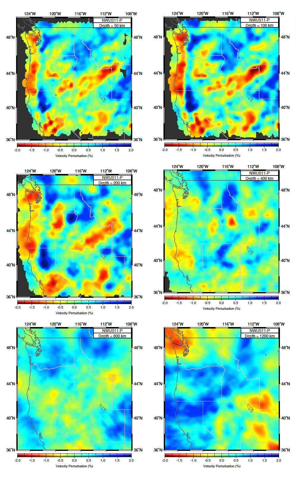
A 3-D P-wave tomography model for the northwestern United States, James et al. (2011) . The P-wave inversion for NWUS11-P is based on a total of 79,212 rays from 461 teleseismic events, with typical bandpass filter range of 0.5-1.5 Hz. The percent velocity perturbations reported by this model are insensitive to the starting 1-D reference model.
Quicklinks
Description
| Name | NWUS11-P |
| Title | A 3-D P-wave tomography model for the northwestern United States |
| Type | 3-D Tomography Earth Model |
| Sub Type | P velocity perturbation (%) |
| Year | 2011 |
| Short Description | NWUS11-P is based on the analysis of relative arrival times of P-waves, obtained primarily from multi-channel cross correlation of recordings at USArray Transportable Array (TA) and the High Lava Plains seismic experiment (James et al. (2011) ). |
| Authors: | |
| David E. James | |
| Department of Terrestrial Magnetism | |
| Carnegie Institution of Washington | |
| Washington, DC | |
| Matthew J. Fouch | |
| School of Earth and Space Exploration | |
| Arizona State University | |
| (now at Department of Terrestrial Magnetism, Carnegie Institution of Washington) | |
| Tempe, Arizona | |
| Richard W. Carlson | |
| Department of Terrestrial Magnetism | |
| Carnegie Institution of Washington | |
| Washington, DC | |
| Jeffrey B. Roth | |
| ExxonMobil Exploration Company | |
| Houston, TX | |
| Previous Model | |
| Reference Model | N/A |
| Model Download | |
| NWUS11-P model in its original format as a compressed text file (NWUS11-P.txt.gz ) that includes the model values from each node of the P-wave model for depths of good resolution (50 km to 1200 km depth). Note that the nodes grow larger toward the lateral edges and the bottom of the model (see text for details). The order of columns is: Depth(km) Latitude(deg N) Longitude(deg W) %velocity_perturbation. A value of “999.00000” signifies a node with a low hit count and is thus considered very poorly constrained. | |
| NWUS11-P_percent.nc (see metadata ), is the netCDF file for the model | |
| Model Homepage | |
| Depth Coverage | 50 to 1200 km |
| Area | Northwestern United States (32°/54°, -130°/-104°) |
| Data Set Description | [ James et al. (2011) ] The P-wave inversion for NWUS11-P is based on a total of 79,212 rays from 461 teleseismic events, with typical bandpass filter range of 0.5-1.5 Hz. |

Citations and DOIs
To cite the original work behind this Earth model:
- James D.E., M.J. Fouch, R.W. Carlson and J.B. Roth. 2011. “Slab fragmentation, edge flow and the origin of the Yellowstone hotspot track.” Earth Planet. Sci. Lett., https://doi.org/10.1016/j.epsl.2011.09.007.
To cite IRIS DMC Data Products effort:
- Trabant, C., A. R. Hutko, M. Bahavar, R. Karstens, T. Ahern, and R. Aster (2012), Data Products at the IRIS DMC: Stepping Stones for Research and Other Applications, Seismological Research Letters, 83(5), 846–854, https://doi.org/10.1785/0220120032.
DOI for this EMC webpage:
Credits
Model provided by Matthew J. Fouch
Timeline
- 2011-10-03
- Online


