Summary
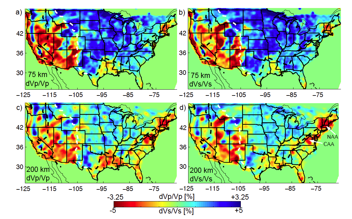
US-SL-2014 model, Schmandt & Lin (2014), is a P and S teleseismic body-wave tomography of the mantle beneath the United States.
Quicklinks
Description
| Name | US-SL-2014 |
| Title | P and S teleseismic body-wave tomography of the mantle beneath the United States |
| Type | 3-D Tomography Earth Model |
| Sub Type | P and S velocity perturbations(%) |
| Year | 2014 |
| Short Description |
Teleseismic travel-time residuals from the EarthScope Transportable Array and more than 1900 additional stations are inverted for 3-D velocity perturbations. The inversion uses frequency-dependent 3-D sensitivity kernels to map travel-time residuals, measured in multiple frequency bands, into velocity structure. A surface-wave tomography starting model was used to mitigate the potential for crustal structure to create artifacts at mantle depths. |
| Authors: | |
| Brandon Schmandt | |
| Department of Earth and Planetary Science | |
| University of New Mexico | |
| Fan-Chi Lin | |
| Department of Geology and Geophysics | |
| University of Utah | |
| Previous Model | wUS-SH-2010 |
| Reference Model | N/A |
| Model Download | |
| US-SL-2014_percent.nc (see metadata ), is the netCDF file for the model | |
| Model Homepage | |
| Depth Coverage | 60 — 1220 km |
| Area | The contiguous United States (approx. 24° to 50° Latitude and -125° to -67° Longitude) |
| Data Set Description | The dataset includes 516,688 multi-frequency P-wave travel time residuals and 223,462 S-wave travel time residuals. |
| Supplemental Information | |

Citations and DOIs
To cite the original work behind this Earth model:
- Schmandt, B., and F.-C. Lin (2014), P and S wave tomography of the mantle beneath the United States, Geophys. Res. Lett., 41, https://doi.org/10.1002/2014GL061231.
To cite IRIS DMC Data Products effort:
- Trabant, C., A. R. Hutko, M. Bahavar, R. Karstens, T. Ahern, and R. Aster (2012), Data Products at the IRIS DMC: Stepping Stones for Research and Other Applications, Seismological Research Letters, 83(5), 846–854, https://doi.org/10.1785/0220120032.
DOI for this EMC webpage:
Credits
Model provided by Brandon Schmandt
Timeline
- 2014-10-21
- US-SL-2014 online : US-SL-2014 model added to EMC


