Summary
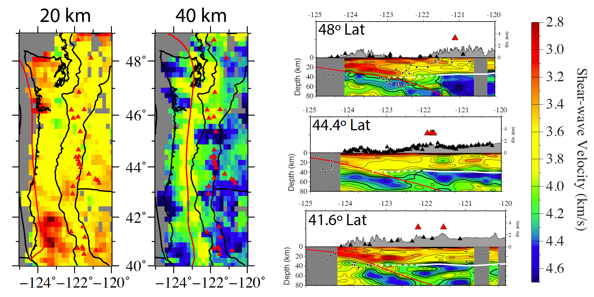
3D vertical shear-wave velocity model of the Cascadian forearc from the joint inversion of ambient noise dispersion and receiver functions
Quicklinks
Description
| Name | Cascadia_ANT+RF_Delph2018 |
| Title | 3D vertical shear-wave velocity model of the Cascadian forearc from the joint inversion of ambient noise dispersion and receiver functions. |
| Type | 3-D Tomography Earth Model |
| Sub Type | Shear-wave velocity (km/s) |
| Year | 2018 |
| Short Description | This model was created from the joint inversion of ambient noise Rayleigh waves dispersion measurements (8-50 seconds) and adaptive CCP-derived receiver functions (see Delph et al., 2015, 2017 for details of methodology; Delph et al., 2018 for details of this model). |
| Authors: | |
| Jonathan R. Delph | |
| Department of Earth, Environmental and Planetary Sciences | |
| Rice University | |
| Alan Levander | |
| Department of Earth, Environmental and Planetary Sciences | |
| Rice University | |
| Fenglin Niu | |
| Department of Earth, Environmental and Planetary Sciences | |
| Rice University | |
| Previous Model | None |
| Reference Model | None |
| Model Download | Cascadia-ANT+RF-Delph2018.nc (see metadata ), is the netCDF file for the model as a function of depth |
| Model Homepage | |
| Depth Coverage | -3 to 80 km (bsl) |
| Area | Cascadia forearc to arc (latitude: 40°N to 49°N, longitude: 124.8°W to 120°W) |
| Data Set Description | This model contains data from roughly 1000 broadband seismic stations distributed throughout the western United States. Time period of data is 1993-1994, 2005-2016. |

Citations and DOIs
To cite the original work behind this Earth model:
- Delph, J. R., Levander, A., & Niu, F. (2018). “Fluid Controls on the Heterogeneous Seismic Characteristics of the Cascadia Margin”. Geophysical Research Letters, 45(20), 11,021-11,029. https://doi.org/10.1029/2018GL079518
To cite IRIS DMC Data Products effort:
- Trabant, C., A. R. Hutko, M. Bahavar, R. Karstens, T. Ahern, and R. Aster (2012), Data Products at the IRIS DMC: Stepping Stones for Research and Other Applications, Seismological Research Letters, 83(5), 846–854, https://doi.org/10.1785/0220120032.
DOI for this EMC webpage:
References
- Delph, J.R., Ward, K.M., Zandt, G., Ducea, M.N., and Beck, S.L., 2017, Imaging a magma plumbing system from MASH zone to magma reservoir: Earth and Planetary Science Letters, v. 457, p. 313–324, https://doi.org/10.1016/j.epsl.2016.10.008.
- Delph, J.R., Zandt, G., and Beck, S.L., 2015, A new approach to obtaining a 3D shear wave velocity model of the crust and upper mantle: An application to eastern Turkey: Tectonophysics, v. 665, https://doi.org/10.1016/j.tecto.2015.09.031.
Credits
Model provided by Jonathan R. Delph
Timeline
- 2019-04-15
- online


