Summary
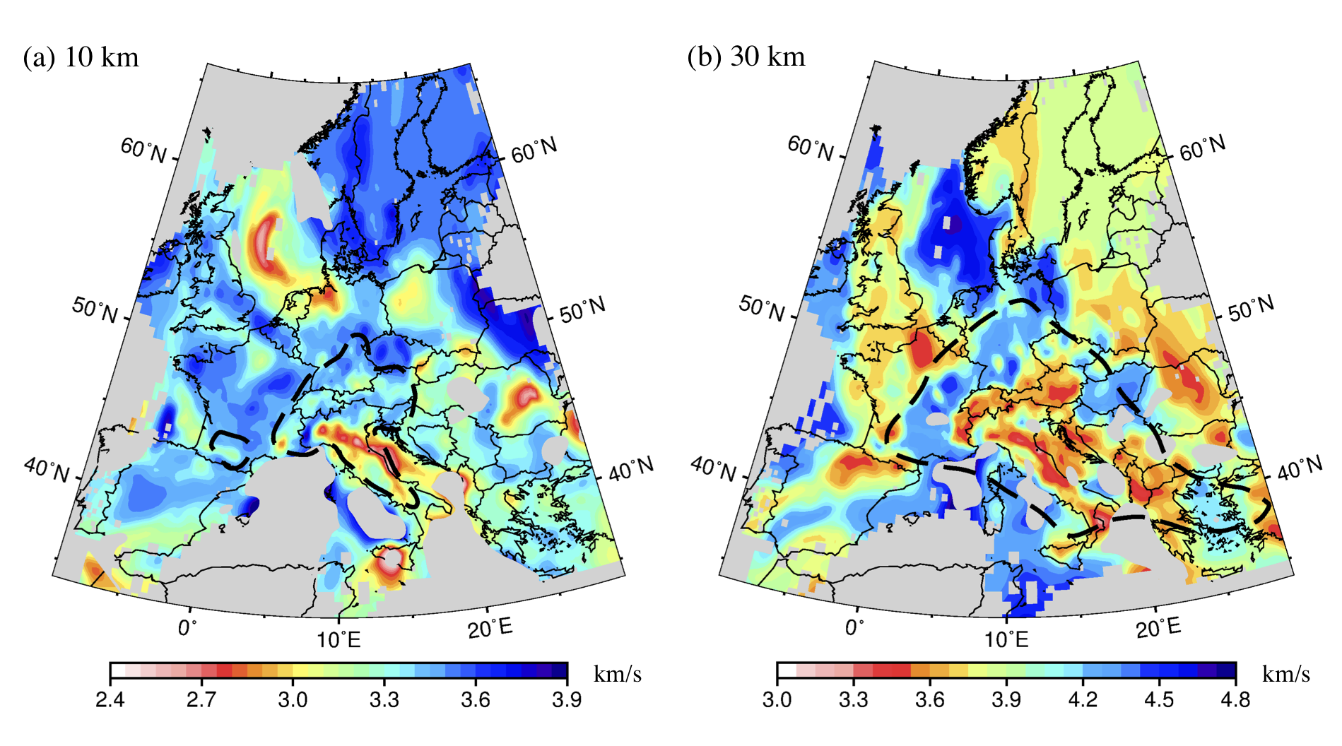
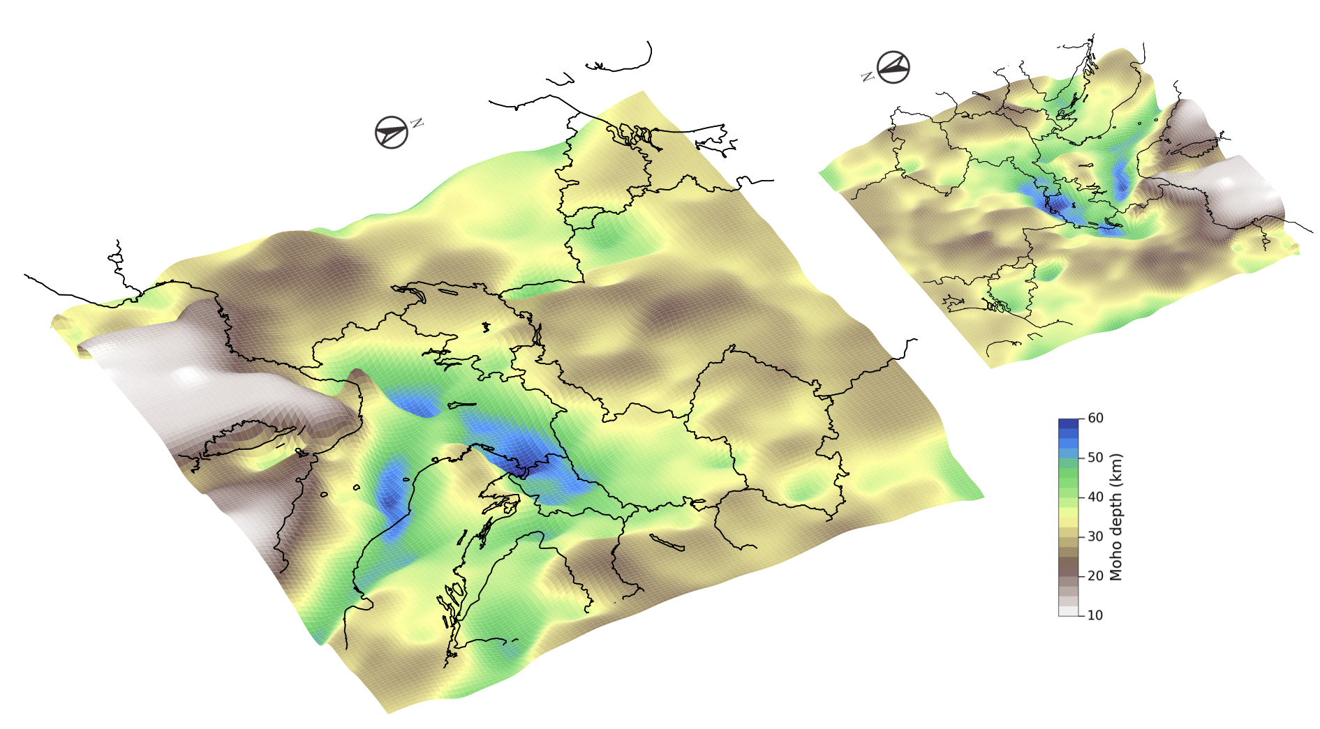
LSP_Eucrust1.0 is a new high-resolution model for the European crust and uppermost mantle. It contains an isotropic shear-wave velocity model and a probabilistic model (the probability of having an interface at certain depth).
Quicklinks
Description
| Name | LSP_Eucrust1.0 | ||
| Title | 3D shear-wave velocity model for the European crust and uppermost mantle from ambient noise tomography | ||
| Type | 3-D Tomography Earth Model | ||
| Sub Type | Shear-wave velocity (km/s) | ||
| Year | 2018 | ||
| Short Description | LSP_Eucrust1.0 is a new high-resolution model for the European crust and uppermost mantle. It contains an isotropic shear-wave velocity model and a probabilistic model (the probability of having an interface at certain depth). The model is derived by ambient noise tomography using a new collection of large dataset across Europe (4 years continuous seismic recordings from 1293 stations). The Rayleigh wave group velocity dispersions in the period range 5-150 are inverted to obtain Vs and interface probability for the crust and uppermost mantle. The model is validated by comparison with previous geophysical studies, e.g. controlled source seismology and receiver function analysis. |
||
| Authors: | |||
| Yang Lu Institut des Sciences de la Terre (ISTerre), CNRS, Univ. Grenoble Alpes, 1381 Rue de la Piscine, Grenoble, FR | |||
| Laurent Stehly Institut des Sciences de la Terre (ISTerre) , CNRS, Univ. Grenoble Alpes, 1381 Rue de la Piscine, Grenoble, FR | |||
| Anne Paul Institut des Sciences de la Terre (ISTerre), CNRS, Univ. Grenoble Alpes, 1381 Rue de la Piscine, Grenoble, FR | |||
| AlpArray Working Group www.alparray.ethz.ch | |||
| Previous Model | None | ||
| Reference Model | None | ||
| Model Homepage | https://sites.google.com/view/seismology-yanglu | ||
| Model Download | LSP-Eucrust1.0.nc (see metadata), is the netCDF file for the model | ||
| Depth Coverage | 0.5 to 79.5 km (below earth surface) | ||
| Area | Europe (latitude 34.125°N/65.925°N, longitude: 9.975°W/29.925°E) | ||
| Data Set Description | The raw data contains up to 4 yr (July 2012–June 2016) of continuous seismic noise recorded by 1293 broad-band stations across Europe (10°W–35°E, 30°N–70°N; see Section 7 of Lu et al. 2018 for more details). The data were obtained through the EIDA (European Integrated Data Archive) data query interface. | ||


Citations and DOIs
To cite the original work behind this Earth model:
- Yang Lu, Laurent Stehly, Anne Paul, AlpArray Working Group, High-resolution surface wave tomography of the European crust and uppermost mantle from ambient seismic noise, Geophysical Journal International, Volume 214, Issue 2, August 2018, Pages 1136–1150, https://doi.org/10.1093/gji/ggy188
To cite IRIS DMC Data Products effort:
- Trabant, C., A. R. Hutko, M. Bahavar, R. Karstens, T. Ahern, and R. Aster (2012), Data Products at the IRIS DMC: Stepping Stones for Research and Other Applications, Seismological Research Letters, 83(5), 846–854, https://doi.org/10.1785/0220120032.
DOI for this EMC webpage:
Credits
Model provided by Yang Lu
Timeline
- 2020-06-18
- online


