Summary
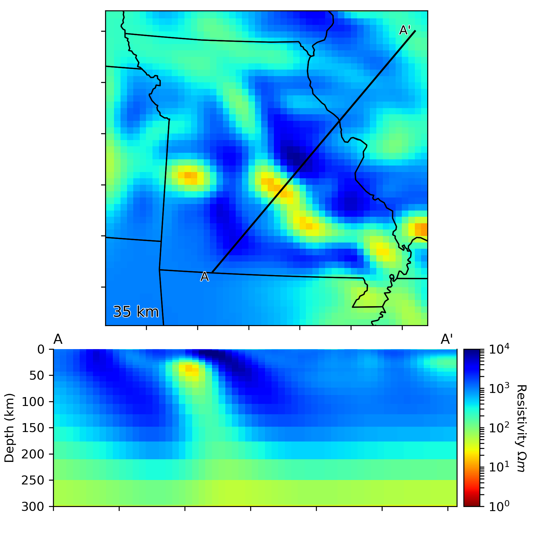
MHCB-MT is a three-dimensional electrical resistivity Earth model for the Missouri High Conductivity Belt and the surrounding region.
Quicklinks
Description
| Name | MHCB-MT |
| Title | Missouri High Conductivity Belt 3-D Electrical Resistivity Model |
| Type | 3-D Electrical Resistivity Earth Model |
| Sub Type | |
| Units | |
| Year | 2019 |
| Short Description | Three-dimensional electrical resistivity model for the Missouri High-Conductivity Belt and surrounding region. Inverse solution was found using ModEM. |
| Authors: | |
| Michael S. DeLucia | |
| The Department of Geology | |
| University of Illinois, Urbana-Champaign | |
| Urbana, IL 61801, USA | |
| Benjamin S. Murphy | |
| College of Earth, Ocean and Atmospheric Sciences | |
| Oregon State University | |
| Corvallis, OR 97331, USA | |
| Stephen Marshak | |
| The Department of Geology | |
| University of Illinois, Urbana-Champaign | |
| Urbana, IL 61801, USA | |
| Gary D. Egbert | |
| College of Earth, Ocean and Atmospheric Sciences | |
| Oregon State University | |
| Corvallis, Oregon 97331, USA | |
| Previous Model | None |
| Reference Model | None |
| Model Download | MHCB.MT.DeLuciaetal2019.resistivity.nc (see metadata ), is the re-gridded (in latitude/longitude) netCDF file for the model and MHCB-MT.zip is the above model in its original format (the model in the original inversion coordinate system). |
| Model Homepage | None |
| Depth Coverage | 0 to 400 km |
| Area | Latitude 35.5° – 43.0°, Longitude -96.0° – -81.5° |
| Data Set Description | Inversion used 160 EarthScope USArray MT stations (full impedance tensors and vertical magnetic field transfer functions, period range ~10-10000 s). |
| Model Value Range | 1e0 – 1e5 (note: there will be some values beyond these numbers, but this is the meaningful range of model values) |
| Supplemental Information |

Citations and DOIs
To cite the original work behind this Earth model:
- DeLucia, M.S., Murphy, B.S., Marshak, S., Egbert, G.D., 2019, The Missouri High-Conductivity Belt, revealed by magnetotelluric imaging: Evidence of a trans-lithospheric shear zone beneath the Ozark Plateau, Midcontinent USA?. Tectonophysics 753, 111-123, https://doi.org/10.1016/j.tecto.2019.01.011
To cite IRIS DMC Data Products effort:
- Trabant, C., A. R. Hutko, M. Bahavar, R. Karstens, T. Ahern, and R. Aster (2012), Data Products at the IRIS DMC: Stepping Stones for Research and Other Applications, Seismological Research Letters, 83(5), 846–854, https://doi.org/10.1785/0220120032.
DOI for this EMC webpage:
Credits
Model provided by Benjamin S. Murphy
Timeline
- 2019-04-17
- online


