Summary
Provisional
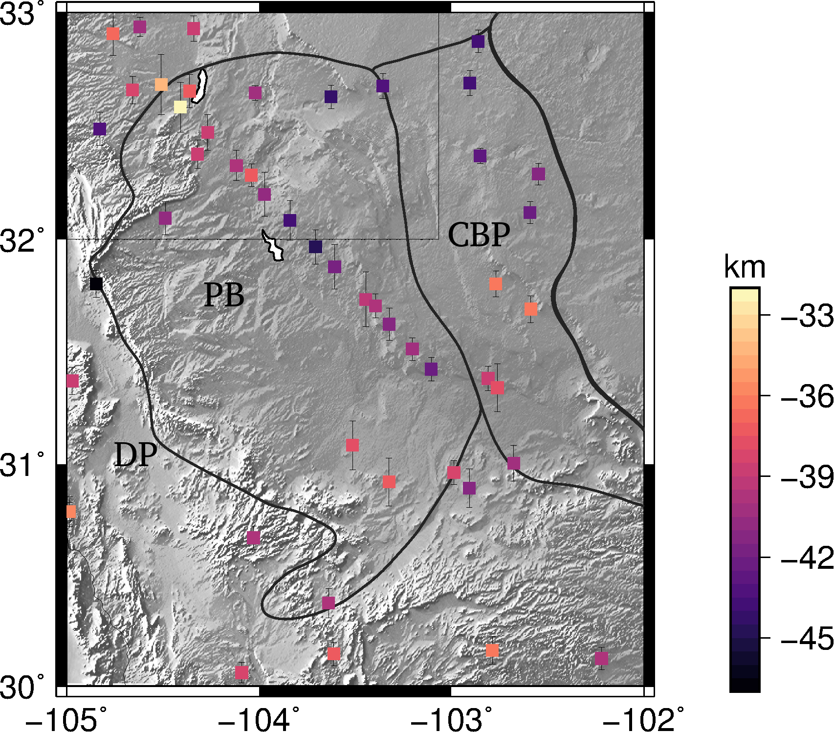
The models of Moho depth, crustal Vp/Vs ratio, depth of sedimentary velocity discontinuity, and sedimentary Vp/Vs ratio in the Permian Basin region were derived from P receiver functions.
Quicklinks
Description
Provisional
| Name | PermianBasinRegion_SedimentCrust2019 |
| Title | Seismic Features of the Permian Basin Region from Receiver Function Analysis |
| Type | Moho depth, crustal Vp/Vs ratio, depth of sedimentary velocity discontinuity, and sedimentary Vp/Vs ratio |
| Sub Type | |
| Year | 2019 |
| Short Description | The models of Moho depth, crustal Vp/Vs ratio, depth of sedimentary velocity discontinuity, and sedimentary Vp/Vs ratio in the Permian Basin region were derived from P receiver functions. |
| Authors: | |
| Peng Li | |
| Bureau of Economic Geology, Jackson School of Geosciences | |
| The University of Texas at Austin | |
| 10100 Burnet Road, Austin, TX, 78758, USA | |
| Previous Model | N/A |
| Reference Model | N/A |
| Model Download | Moho_Depth_Error.nc (see metadata), is the netCDF Moho depth model expressed as depth in km Crust_VpVs_ratio_Error.nc (see metadata), is the netCDF of the crustal Vp/Vs ratio Sedimentary_Velocity_Discontinuity_Depth_Error.nc (see metadata), is the netCDF file of the Sedimentary velocity discontinuity depth model expressed as depth in km Sedimentary_VpVs_Ratio_Error.nc (see metadata), is the netCDF of Sedimentary Vp/Vs ratio |
| Original Model Repository | |
| Depth Coverage | |
| Area | Permian Basin region (latitude: 30.0°/33.0°; longitude: -105.0°/-102.2°) |
| Data Set Description | The models include: 1) Moho depth values. 2) Crustal Vp/Vs ratio values. 3) Sedimentary velocity discontinuity depth values. And 4) Sedimentary Vp/Vs ratio. We obtained 3120 receiver functions in the Permian Basin region, and then applied waveform fitting method to derive the depth and Vp/Vs ratio models. The sedimentary velocity discontinuity refers to the first-order velocity discontinuity in sediment basin, above the basin basement. Sea level is zero depth. |
| Supplemental Information | |

Delaware Basin; CBP: Central Basin Platform.
Citations and DOIs
To cite the original work behind this Earth model:
To cite IRIS DMC Data Products effort:
- Trabant, C., A. R. Hutko, M. Bahavar, R. Karstens, T. Ahern, and R. Aster (2012), Data Products at the IRIS DMC: Stepping Stones for Research and Other Applications, Seismological Research Letters, 83(5), 846–854, https://doi.org/10.1785/0220120032.
DOI for this EMC webpage:
- doi:
Credits
Model provided by Peng Li


