IRIS DMS Mapping Tools
Coordinate Acquisition Tool (CAT)
CAT has been integrated into the DMC SeismiQuery software application that provides access to all IRIS seismic data. CAT provides an easy way to fetch geographic coordinates from a simple map interface.
CAT-enabled SeismiQuery | Learn more
GeoWS
The GeoWS group formed in August 2006 between cooperating data centers in a development effort to integrate their data sets in an OGC-standard mapping environment.
GeoWS | Learn more
IRIS GeoWS Map Demonstration Page
As a part of ongoing GeoWS development, IRIS has created some convenient sample WMS maps that run right in your web browser (except for Safari 2 and earlier), allowing the user to explore the globe and view map layers for stations and events.
IRIS GeoWS Map Demos
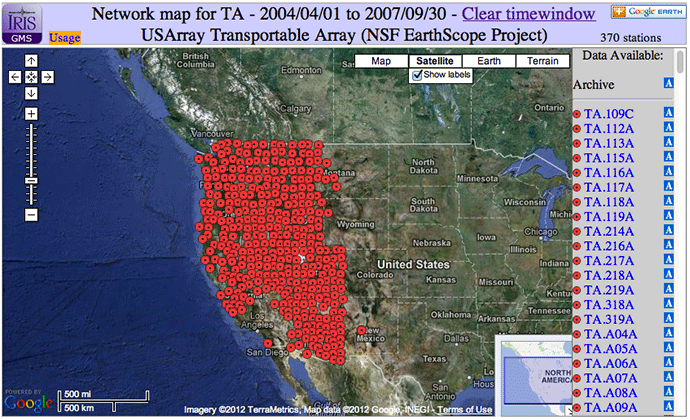
Google Map Service (GMS)
The Google Map generator creates maps based on IRIS DMC metadata holdings. Requesting data directly from the IRIS DMC Oracle database the GMS creates dynamic station maps that can be panned and zoomed. The GMS can produce network, single station or arbitrary station set maps. Users can generate a kml file to view stations in Google Earth.
GMS | Google Earth | Learn more
IRIS Earthquake Browser (IEB)
The IEB combines the DMC’s large database of earthquakes with the popular Google Maps web interface. The IEB is useful both educationally and as a research tool. With the IEB you can quickly find earthquakes in any region of the globe and then import this information into the GEON Integrated Data Viewer (IDV) where the hypocenters may be visualized in three dimensions.
Metadata Aggregator (MDA)
The MetaData Aggregator (MDA) returns metadata summaries from the IRIS DMC database including data availability and links to further services. Five levels of summary are available: network list, network, station, location and channel.

by Tim Knight (IRIS Data Management Center)


