Summary
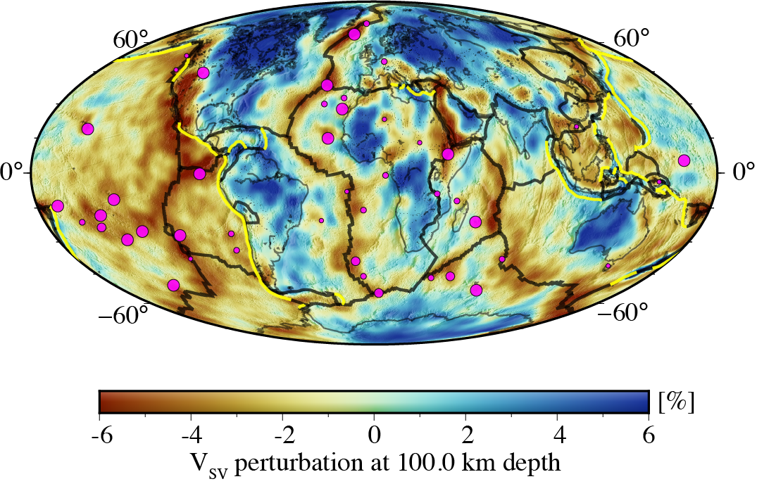
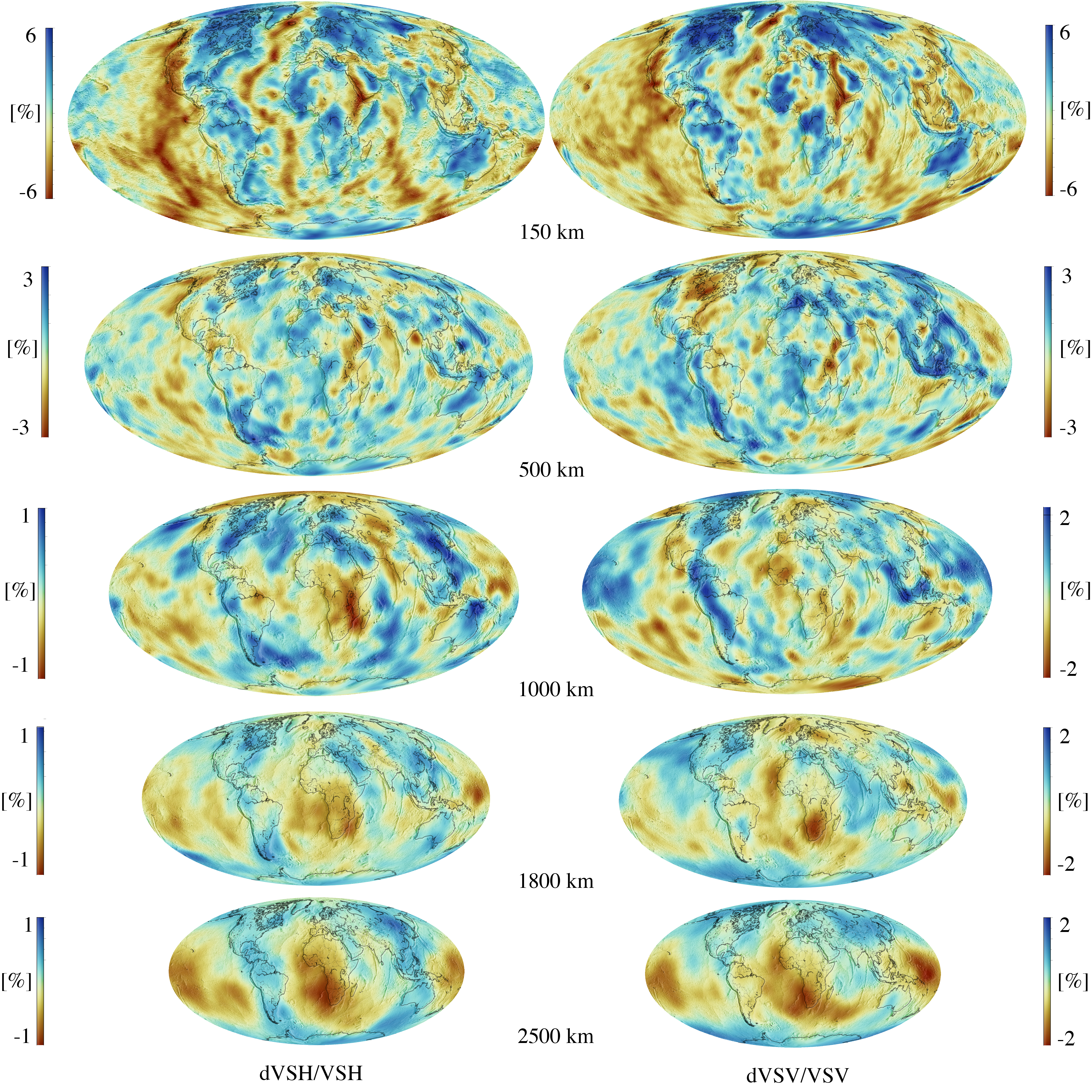
Global transversely isotropic Earth model created by inverting a dataset of 1179 earthquakes using full-waveform inversion.
Quicklinks
Description
| Name | LOWE |
| Title | LOng Wavelength Earth model |
| Type | 3-D Tomography Earth Model |
| Sub Type | Velocity (km/s) |
| Year | 2022 |
| Data Revision | r0.0 (revision history) |
| Short Description | Global transversely isotropic Earth model created by inverting a dataset of 1179 earthquakes using full-waveform inversion. 72 iterations were performed at a period range of 100-200 s resulting in a smooth global velocity model which does not contain any 3D imprints of a starting model. The starting model was the one-dimensional isotropic PREM model with a smooth 3D crustal model. |
| Authors: | Solvi Thrastarson, Department of Earth Sciences, Institute of Geophysics, ETH Zürich, Sonneggstrasse 5, 8092 Zürich, Switzerland Dirk-Philip van Herwaarden, Department of Earth Sciences, Institute of Geophysics, ETH Zürich, Sonneggstrasse 5, 8092 Zürich, Switzerland Lion Krischer, Department of Earth Sciences, Institute of Geophysics, ETH Zürich, Sonneggstrasse 5, 8092 Zürich, Switzerland Christian Boehm, Department of Earth Sciences, Institute of Geophysics, ETH Zürich, Sonneggstrasse 5, 8092 Zürich, Switzerland Martin van Driel, Department of Earth Sciences, Institute of Geophysics, ETH Zürich, Sonneggstrasse 5, 8092 Zürich, Switzerland Michael Afanasiev, Department of Earth Sciences, Institute of Geophysics, ETH Zürich, Sonneggstrasse 5, 8092 Zürich, Switzerland Andreas Fichtner, Department of Earth Sciences, Institute of Geophysics, ETH Zürich, Sonneggstrasse 5, 8092 Zürich, Switzerland |
| Reference Model | N/A |
| Prior Model | N/A |
| Model Homepage | https://cos.ethz.ch/models.html |
| Model Download | LOWE.r0.0.nc (see metadata) (377MB) the model in netCDF 3 Classic format. LOWE.r0.0-n4.nc (see metadata) (155MB) the same model in netCDF 4 Classic format with compression. |
| Usage Notes | The netCDF file is good for visual inspection of the model, for running simulations we recommend downloading the HDF5 version of the model. That version can be obtained from: https://cos.ethz.ch/models.html |
| Depth Coverage | 0 to 2880 km, surface to core-mantle boundary |
| Area | Global |
| Data Set Description | Publicly available waveform data for 1179 earthquakes were downloaded using the FDSN web services and moment tensor data from the GCMT catalog. All data used is public. |


Citations and DOIs
To cite the original work behind this Earth model:
- Solvi Thrastarson, Dirk-Philip van Herwaarden, Lion Krischer, Christian Boehm, Martin van Driel, Michael Afanasiev, Andreas Fichtner, Data-adaptive global full-waveform inversion, Geophysical Journal International, Volume 230, Issue 2, August 2022, Pages 1374–1393, https://doi.org/10.1093/gji/ggac122
To cite IRIS DMC Data Products effort:
- Trabant, C., A. R. Hutko, M. Bahavar, R. Karstens, T. Ahern, and R. Aster (2012), Data Products at the IRIS DMC: Stepping Stones for Research and Other Applications, Seismological Research Letters, 83(5), 846–854, https://doi.org/10.1785/0220120032.
DOI for this EMC webpage: https://doi.org/10.17611/dp/emc.2023.lowe.1
Credits
- r0.0 model provided by Solvi Thrastarson.
Revision History
revision r0.0: uploaded September 12, 2023.
Timeline
- 2023-09-13
- r0.0 online


