January 2010 M7.0 Haiti Quake
January 12, 2010 (21:53:10 UTC)
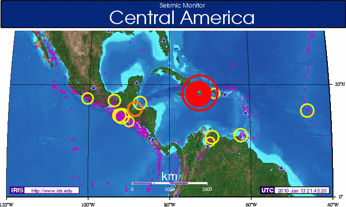
A major earthquake occurred Tuesday, January 12, 2010 in the boundary region separating the Caribbean plate and the North America plate. This plate boundary is dominated by left-lateral strike slip motion and compression, and accommodates about 20 mm/y slip, with the Caribbean plate moving eastward with respect to the North America plate. The location and magnitude was available via IRIS Seismic Monitor minutes after the earthquake was reported by USGS.
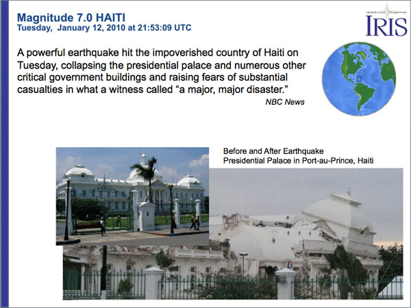
The magnitude 7.0 earthquake that struck Haiti in 2010 was the strongest to hit the island in over two centuries. The initial earthquake drew thousands of visitors to the IRIS website and a lot of interest in the teachable moment information developed by IRIS Education and Outreach staff.
The Teachable Moment Presentations feature PowerPoint slides created in the first hours after the earthquake with information to use in middle school, high school or college classes. There is an IRIS Earthquake Notice in pdf format and USArray Wave Visualization movie.
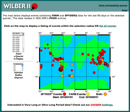
Seismologists accessed WILBER to generate station maps, build custom Record Section Plots and access seismic data. The WILBER web page, displayed above, shows the distribution of earthquakes in the first quarter of 2010.
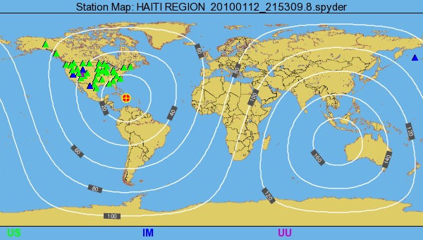
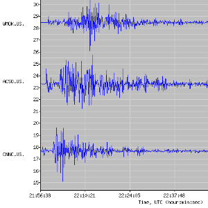
This record section plot displays vertical displacements of the Earth’s surface recorded by seismometers plotted with time (since the earthquake initiation) on the horizontal axis, and vertical displacements of the Earth on the vertical axis. The traces are arranged by distance from the epicenter in degrees.
Haiti Waveform Data
Getting data using WILBER
| Date and Time | Source | Magnitude | Latitutde | Longitude | Depth | Description |
|---|---|---|---|---|---|---|
| 2010/01/12 21:53:09.8 | SPYDER® | M7.0 | 18.45 | -72.45 | 10.00 | Haiti Region |
| 2010/01/12 21:53:10.0 | FARM | M7.0 | 18.44 | -72.57 | 13.00 | Haiti Region |
USArray Ground Motion Visualizations
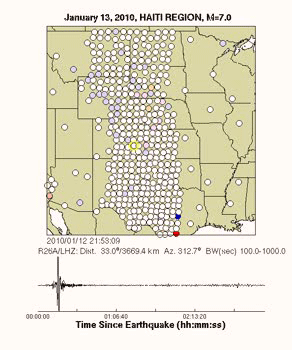
The Transportable Array component of the USArray/EarthScope project is a rolling array of 400 broadband stations deployed on a uniform 70-km grid. This very large aperture array is well suited to visualize seismic waves crossing the contiguous United States. The USArray Ground Motion Visualization (GMV) videos below illustrate how seismic waves from large earthquakes sweep across this array by depicting the recorded wave amplitudes at each seismometer location using colored circles.
The color of each circle represents the amplitude of the ground motion as detected by the station’s seismometer and it changes as waves of differing amplitude travel past the seismometer. Blue circles represent downward ground motion while the red circles represent upward ground motions with the darker colors indicating larger amplitudes.
- Supplementary Information
- Haiti Visualization Video (mp4)
- Download the waveform data (SAC/SEED format) that were used to create the visualization for this event.
View the BREQ_FAST request for this visualization.
BREQ_FAST request
Use this BREQ_FAST request to obtain the most recent waveform data for this event.
.NAME your name
.EMAIL you@email.address
.LABEL GMV Event 3585331
.MEDIA FTP
.QUALITY B
.SOURCE ~NEIC NEICALRT~ ~ ~
.HYPO ~2010 01 12 21 53 09~18.451~-72.445~10~7~87~HAITI REGION~
.MAGNITUDE ~7.0~MW~
.END
* _US-TA 2010 01 12 21 53 09 2010 01 13 01 08 09 1 LHZ
* _US-REF 2010 01 12 21 53 09 2010 01 13 01 08 09 1 LHZ
Web traffic
The initial M7.0 quake set a record for visits to the IRIS website. The M5.9 aftershock one week later resulted in a second spike in IRIS web traffic (see graph comparing 2009 vs 2010).
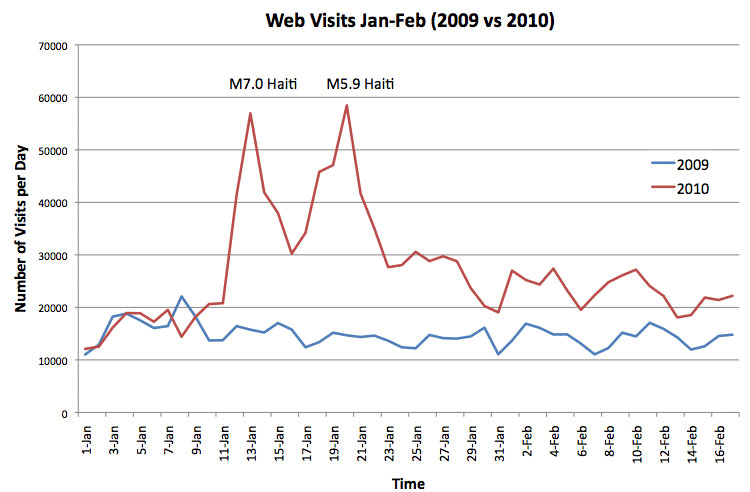
Web visits increased substantially in January 2010 due to the interest in the Haiti earthquake. Starting Jan 12th, web traffic jumped over 350% compared with the previous year. Seismic Monitor had the most visitors in IRIS history.
Software Distribution
How does a major earthquake affect IRIS software downloads?
Comparing software distributed in January 2010 vs Jan 2009:
- jrdseed – up 381%
- JWEED – up 92%
- rdseed – up 61%
- SAC – up 39%
You can see that there was a large increase in software downloads as a result of a major earthquake.
More information
by Tim Knight (IRIS Data Management Center)


