About SPUD

SPUD Version 3.0

The Searchable Product Depository (SPUD) is the IRIS DMC's primary data product management system. Complementing the DMC's SEED and assembled data archives, which contain time series recordings, the SPUD system primarily contains derivative data products of other types (images, movies, etc.) created either at the DMC or by members of the community.

For users SPUD is the query and access point for these products. The web interfaces allow users to search for products using customized queries across product and event details. Users can search across all product types at once or within specific product types. SPUD also has web service interfaces for programmatic discovery and access to the data products.

If any products from SPUD are used in your research please be sure to cite the identified author of the product and the IRIS DMS [Citation Information].
About Earth Model Products

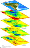
The Earth models presented here are contributed to the IRIS Earth Model Collaboration (EMC) by various researchers.

Two general types of model are available for download:

  • Tomography Models:
    The contributed Earth models in their original format and in a common netCDF (network Common Data Form). A model overview page provides a summary of the model.

  • Reference Models:
    Most EMC Earth models are expressed as perturbations relative to a particular reference 1-D model. These reference models are available for download in expanded comma separated value (CSV) file format with the first two lines representing the file’s header.

For model visualization and additional information about the models visit the IRIS EMC Product Page.

Citing Earth Model Products

If you use Earth Models in publications, please cite according to the instructions at:

Schmandt, B., Lin, F. C., & Karlstrom, K. E. (2015). Distinct crustal isostasy trends east and west of the Rocky Mountain Front. Geophysical Research Letters. doi:10.1002/2015GL066593

http://ds.iris.edu/ds/products/emc/#citation

When citing this Earth Model page please use the Digital Object Identifier (DOI):

doi:10.17611/DP/11243386

Earth Model Help

The page displays information for individual Earth Models.

The model information is summarized at the top including links to further information.

Crust thickness and Crust and Uppermost mantle Vs model for the contiguous U.S. icon
Model Summary
Name:  US-CrustVs-2015
Title:  Crust thickness and Crust and Uppermost mantle Vs model for the contiguous U.S.
Type: 3-D tomography Earth Model
Sub Type:  Absolute Vs (km/s)
Year 2015
Author(s): Brandon Schmandt
Department of Earth and Planetary Science
University of New Mexico

Fan-Chi Lin
Department of Geology and Geophysics
University of Utah
Reference(s): Schmandt, B., Lin, F. C., & Karlstrom, K. E. (2015). Distinct crustal isostasy trends east and west of the Rocky Mountain Front. Geophysical Research Letters. doi:10.1002/2015GL066593
DOI: doi:10.17611/DP/11243386
Depth Coverage: - km
Areal Coverage: Latitude: 25.6 to 49.0 Longitude: -124.7 to -67.1
Model Description Multimode receiver function stacking and measurements of Rayleigh wave phase velocity and ellipticity were used to estimate crust thickness and crust and uppermost mantle Vs beneath the contiguous U.S.
Data Set Description Teleseismic P-to-s receiver functions, and Rayleigh wave phase velocities and ellipticity from noise interferometry and teleseismic earthquakes.
EMC Page ds.iris.edu/ds/products/emc-us-crustvs-2015/
Model Data
DescriptionSizeModel
model as Latitude, Longitude, Depth, Vs (km/s). The model was pre-gridded on a regular 0.2 degree horizontal grid, with vertical layers every 1 km from 0-60 km and every 20 km from 60 to 120 km. 36.3 MB
model in netCDF format. 8.3 MB
the crust thickness map as Latitude, Longitude, thickness (km) with values rounded to the nearest 1 km for the Vs model. 449.3 KB
crustal thickness in netCDF format. 137.4 KB
mandt et al., 2015] Vs tomography and crustal thickness maps of the U.S.
Model Areal Coverage
Contributions