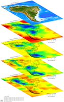
ak135-f velocity model, ak135 full model (spherical average) icon
Model Summary
Name:  MEAN
Title:  ak135-f velocity model, ak135 full model (spherical average)
Type: A 1-D modified IASP91 model
Sub Type:  S velocity
Year 0
Author(s): Federica Marone
Paul Scherrer Institute
5232 Villigen – PSI, Switzerland

Suzan van der Lee
Department of Earth and Planetary Sciences
Northwestern University
Evanston, IL 60208, USA

Reference(s): Marone, F., S. van der Lee and D. Giardini 2004. “Three-dimensional upper-mantle S-velocity model for the Eurasia-Africa plate boundary region.” Geophys. J. Int. 158:109-130.
DOI: doi:10.17611/DP/13618972
Depth Coverage: 0.0 - 6371.0 km
Areal Coverage: Latitude: -90.0 to 90.0 Longitude: -180.0 to 180.0
Model Description MEAN reference Earth model is based on the Earth model IASP91. MEAN replaces IASP91’s mid-crustal discontinuity and Moho depth of 20 and 35 km to 18 and 30 km, respectively. It also replaces IASP91’s a high S-velocity zone of the uppermost mantle (to the depth of 210 km) with a low S-velocity zone less than 4.5 km/s.
Data Set Description
EMC Page ds.iris.edu/ds/products/emc-mean/
Model Data
DescriptionSizeModel
Model Download in its netCDF format with columns left to right representing radius (km), density (g/cm3), Vp (km/s), Vs (km/s), Qκ, and Qμ 6.4 KB
Based On
TypeNameTitleReference
1D ReferenceIASP91iasp91 velocity model Kennett and Engdahl (1991)
Referenced By
TypeNameTitleReference
3-D Tomography Earth Model EAV09 3D shear-wave velocity model of western Eurasia, Arabia, and northern Africa from a joint inversion for multiple data sets Chang et al. (2010)
Figure, Marone et al. (2004), Comparison of 1D S-velocity model (MEAN) with IASP91 (Kennett and Engdahl, 1991).
Model Areal Coverage
Contributions
BESbswy