Summary
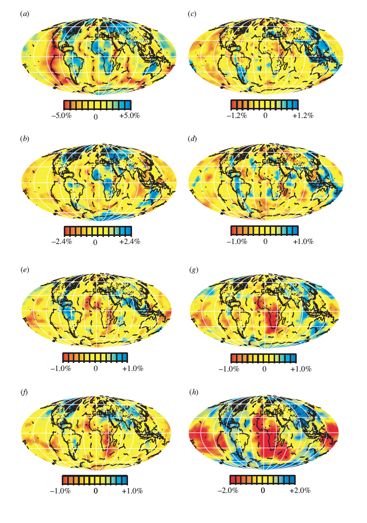
TX2000 (also called Grand2000) refers here to the TXBW, Grand (2002) , model to distinguish it from the TXBW Grand, van der Hilst and Widiyantoro (1997) model. The model is derived from the shear body wave travel times and aims at providing a more uniform global coverage of the mantle and more information on the upper-mantle seismic structure by using analysis of multibounce shear waves, core-reflected waves and SKS and SKKS waves that travel through the core.
Quicklinks
Description
| Name | TX2000 (TXBW, Grand2000) |
| Title | A global mantle shear-wave tomography model |
| Type | 3-D Tomography Earth Model |
| Sub Type | S velocity |
| Year | 2000 |
| Short Description | TX2000 refers here to the TXBW Grand (2002) model to distinguish it from the TXBW Grand, van der Hilst and Widiyantoro (1997) model. The model is derived from the shear body wave travel times and aims at providing a more uniform global coverage of the mantle and more information on upper-mantle seismic structure by using multibounce shear waves, core-reflected waves and SKS and SKKS waves that travel through the core in its analysis. |
| Authors: | |
| Stephen P. Grand | |
| Department of Geological Sciences | |
| The University of Texas, Austin Texasy | |
| Previous Model | |
| Reference Model | An average of models TNA and SNA given in Grand and Helmberger (1984) for the upper mantle and PREM , Dziewonski and Anderson (1981) for the lower mantle. |
| Model Download | Model on a 4°x4° grid for depths from 60 to 2800 km at non-uniform intervals in netCDF format: TX2000_percent.nc (see metadata ), is the netCDF file for the model |
| Model Homepage | See Stephen Grand’s webpage at the Department of Geological Sciences (http://www.jsg.utexas.edu/researcher/stephen_grand ). |
| Depth Coverage | Whole Mantle (60 to 2800 km) |
| Area | Global (-87° to 89°, 0° to 360°) |
| Data Set Description | The data used to derive the model consist of arrive times of several different seismic phases. Earthquake locations were taken from ISC with depth determination based on the S and sS time differences. The seismograms used came from WSSN and Canadian network for older events and more recent seismograms came from a number of global and regional networks (IRIS GSN, GEOSCOPE, MedNet, CNSN and temporary PASSCAL deployments). |

Citations and DOIs
To cite the original work behind this Earth model:
- Grand, S.P. 2002. “Mantle Shear-Wave Tomography and the Fate of Subducted Slabs.” Phil. Trans. R. Soc. Lond. 360:2475-2491. https://doi.org/10.1098/rsta.2002.1077.
To cite IRIS DMC Data Products effort:
- Trabant, C., A. R. Hutko, M. Bahavar, R. Karstens, T. Ahern, and R. Aster (2012), Data Products at the IRIS DMC: Stepping Stones for Research and Other Applications, Seismological Research Letters, 83(5), 846–854, https://doi.org/10.1785/0220120032.
DOI for this EMC webpage:
References
- Dziewonski, A.M., and D.L. Anderson. 1981. “Preliminary reference Earth model.” Phys. Earth Plan. Int. 25:297-356.
- Grand, S.P., and D.V. Helmberger. 1984. “Upper mantle shear structure of North America.” Geophys. J. R. Astr. Soc. 76:399-438.
- Grand, S.P., R.D. van der Hilst, and S. Widiyantoro. 1997. “Global Seismic Tomography: a Snapshot of Convection in the Earth.” GSAToday:1-7.
Credits
Model provided by Stephen P. Grand
Timeline
- 2010-12-19
- added
- 2011-11-14
- renamed from Grand2000 to TX2000


