Summary
The US-Crust-Upper-mantle-Vs.Porter.Liu.Holt.2015 model is based on the shear velocity inversion of Rayleigh wave phase velocities calculated from ambient noise and wave-gradiometry measurements.
Quicklinks
Description
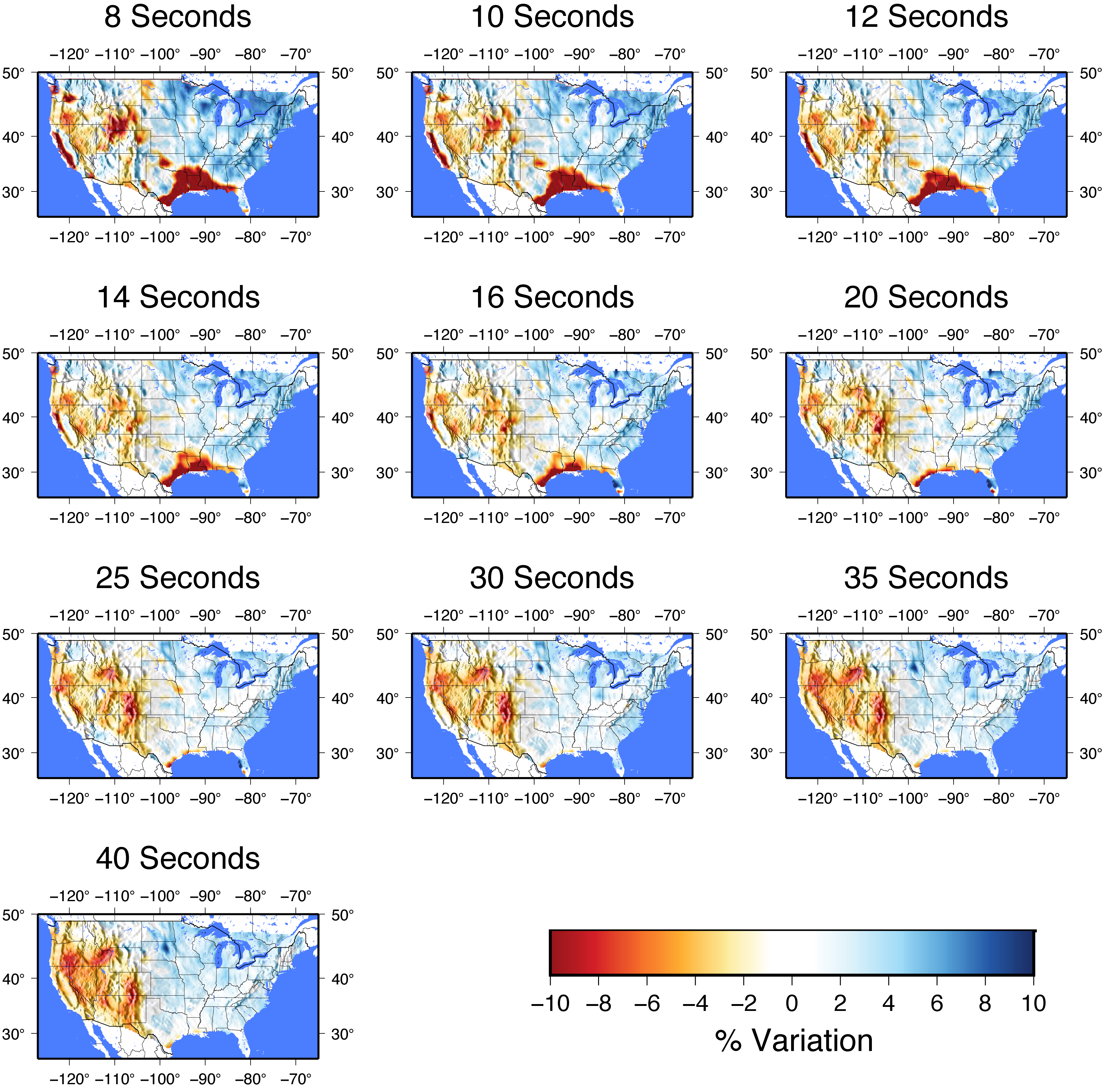
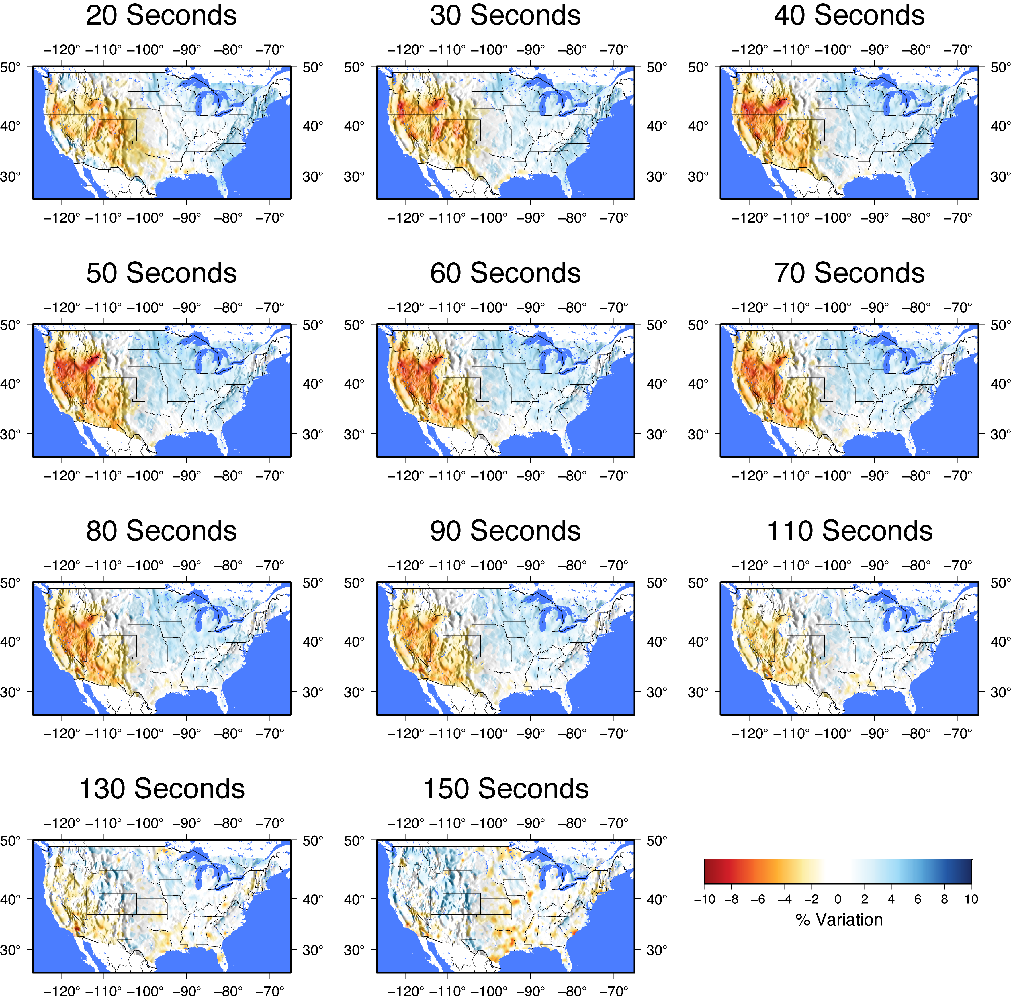
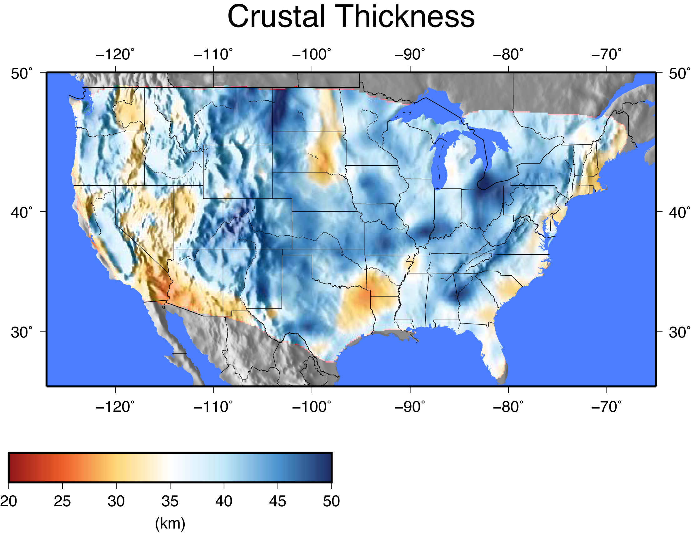
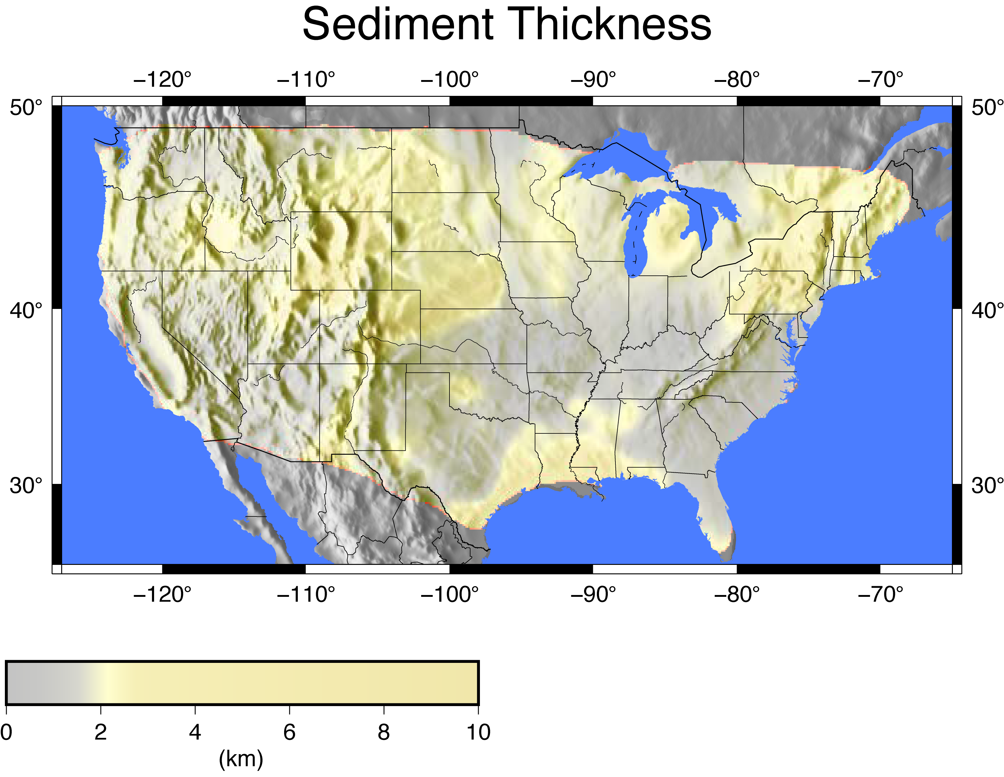
This page contains phase velocity, crustal, and sediment thickness maps for the US-Crust-Upper-mantle-Vs.Porter.Liu.Holt.2015 model.


Citations and DOIs
To cite the source of this Earth model:
- Porter, R., Y. Liu, and W. E. Holt (2016), Lithospheric records of orogeny within the continental U.S., Geophys. Res. Lett., 43, https://doi.org/10.1002/2015GL066950.
To reference the use of this Earth model hosted by EMC:
- IRIS DMC (2016), Data Services Products: US-Crust-Upper-mantle-Vs.Porter.Liu.Holt.2015 model, lithospheric records of orogeny within the continental U.S., https://doi.org/10.17611/DP/EMCUCUMVPLH15MLROWCU.
To cite IRIS Earth Model Collaboration (EMC) data product or reference use of its repository:
- IRIS DMC (2011), Data Services Products: EMC, A repository of Earth models, https://doi.org/10.17611/DP/EMC.1.
Reference
Porter, R., Y. Liu, and W. E. Holt (2016), Lithospheric records of orogeny within the continental U.S., Geophys. Res. Lett., 43, https://doi.org/10.1002/2015GL066950.
Credits
- Ryan Porter
- Yuanyuan Liu
- Bill Holt


